METAR-TAF
Airports :
Rasht Airport
Rasht, Iran
latitude: 37-12N, longitude: 049-38E, elevation: -7 m
Current weather observation
The report was made 33 minutes ago, at 07:30 UTC
Wind 6 kt from the East/Northeast
Temperature 26°C
Humidity 70%
Pressure 1014 hPa
Visibility 10 km or more
Few clouds at a height of 2000 ft, Cumulonimbus.
Scattered clouds at a height of 3000 ft
Broken clouds at a height of 7000 ft
Scattered clouds at a height of 3000 ft
Broken clouds at a height of 7000 ft
METAR: OIGG 290730Z 07006KT 9999 FEW020CB SCT030 BKN070 26/20 Q1014
Time: 12:33 (08:03 UTC)
Forecast
The report was made 2 hours and 33 minutes ago, at 05:30 UTC
Forecast valid from 29 at 06 UTC to 29 at 15 UTC
Wind 8 kt from the Northeast
Visibility: 6000 m
Few clouds at a height of 1500 ft, Cumulonimbus.
Scattered clouds at a height of 2500 ft
Broken clouds at a height of 7000 ft
Scattered clouds at a height of 2500 ft
Broken clouds at a height of 7000 ft
Temporary
from 29 at 08 UTC to 29 at 14 UTC
from 29 at 08 UTC to 29 at 14 UTC
Visibility: 5000 m
Scattered clouds at a height of 1200 ft, Cumulonimbus.
Broken clouds at a height of 2500 ft
Overcast at a height of 6000 ft
Broken clouds at a height of 2500 ft
Overcast at a height of 6000 ft
light rain, mist
TAF: OIGG 290530Z 2906/2915 04008KT 6000 FEW015CB SCT025 BKN070 TEMPO 2908/2914 5000 -RA BR SCT012CB BKN025 OVC060
Weather observations and forecasts of more than 4000 airports (METAR and TAF reports).
The available stations are represented by yellow and red dots on the map.
Hover mouse over dot to see the name of the station.
Then click to see weather observations and forecasts.
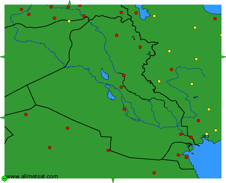
To change the map : click on the green buttons with a black cross to zoom in, on the green button with a dash to zoom out, or on the green arrows for adjacent maps.