Main page
METAR-TAF:

METAR-TAF

Airports :

Ireland West Airport Knock

Knock, Ireland

latitude: 53-54-37N, longitude: 008-49-05W, elevation: 203 m

Current weather observation

The report was made 15 minutes ago, at 15:00 UTC
Wind 11 kt from the Southwest
Temperature 9°C
Humidity 57%
Pressure 1012 hPa
Visibility 10 km or more
Few clouds at a height of 3400 ft
Broken clouds at a height of 3900 ft

METAR: EIKN 091500Z 22011KT 9999 FEW034 BKN039 09/01 Q1012 NOSIG

Time: 15:15 (15:15 UTC)

Forecast

The report was made 4 hours and 15 minutes ago, at 11:00 UTC
Forecast valid from 09 at 12 UTC to 10 at 12 UTC
Wind 9 kt from the West/Southwest
Visibility 10 km or more
Few clouds at a height of 1200 ft
Scattered clouds at a height of 2700 ft
Becoming
from 09 at 16 UTC to 09 at 18 UTC
Wind 10 kt from the South/Southwest
Becoming
from 09 at 20 UTC to 09 at 22 UTC
Wind 12 kt from the South
Becoming
from 09 at 23 UTC to 10 at 01 UTC
Visibility: 3000 m
Broken clouds at a height of 600 ft
light rain, drizzle
Temporary
from 10 at 00 UTC to 10 at 04 UTC
Wind 15 kt from the South with gusts up to 25 kt
Becoming
from 10 at 01 UTC to 10 at 03 UTC
Visibility: 2000 m
Broken clouds at a height of 300 ft
light rain, drizzle, mist
Temporary
from 10 at 04 UTC to 10 at 09 UTC
Visibility: 0500 m
Broken clouds at a height of 100 ft
drizzle, fog
Becoming
from 10 at 09 UTC to 10 at 11 UTC
Wind 13 kt from the South/Southwest
Visibility 10 km or more
Few clouds at a height of 1500 ft
Scattered clouds at a height of 2500 ft
Probability 40% :
Temporary
from 10 at 10 UTC to 10 at 12 UTC
Wind 15 kt from the South/Southwest with gusts up to 25 kt

TAF: EIKN 091100Z 0912/1012 24009KT 9999 FEW012 SCT027 BECMG 0916/0918 21010KT BECMG 0920/0922 17012KT BECMG 0923/1001 3000 -RADZ BKN006 TEMPO 1000/1004 17015G25KT BECMG 1001/1003 2000 -RADZ BR BKN003 TEMPO 1004/1009 0500 DZ FG BKN001 BECMG 1009/1011 20013KT 9999 NSW FEW015 SCT025 PROB40 TEMPO 1010/1012 21015G25KT

Weather observations and forecasts of more than 4000 airports (METAR and TAF reports).

The available stations are represented by yellow and red dots on the map.

Hover mouse over dot to see the name of the station.

Then click to see weather observations and forecasts.

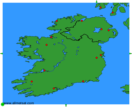
To change the map : click on the green buttons with a black cross to zoom in, on the green button with a dash to zoom out, or on the green arrows for adjacent maps.


METAR-TAF: