Main page
METAR-TAF:

METAR-TAF

Airports :

Casement Aerodrome

Dublin, Ireland

latitude: 53-18-06N, longitude: 6-27-04W, elevation: 318 ft

Current weather observation

The report was made 14 minutes ago, at 06:00 UTC
Wind 21 mph from the South/Southwest
Temperature 55°F
Humidity 88%
Pressure 29.68 in. Hg
Visibility 6.2 miles or more
Few clouds at a height of 1300 ft

METAR: EIME 270600Z 21018KT 9999 FEW013 13/11 Q1005

Time: 06:14 (06:14 UTC)

Forecast

The report was made 1 hour and 14 minutes ago, at 05:00 UTC
Forecast valid from 27 at 06 UTC to 27 at 15 UTC
Wind 20 mph from the Southwest
Visibility 6.2 miles or more
Scattered clouds at a height of 1000 ft
Broken clouds at a height of 1600 ft
Temporary
from 27 at 06 UTC to 27 at 12 UTC
Wind 21 mph from the Southwest with gusts up to 37 mph
Visibility: 22966 ft
Broken clouds at a height of 1000 ft
light rain
Probability 30% :
Temporary
from 27 at 06 UTC to 27 at 10 UTC
Visibility: 13123 ft
Broken clouds at a height of 800 ft
light rain, drizzle
Becoming
from 27 at 12 UTC to 27 at 14 UTC
Wind 23 mph from the West/Southwest with gusts up to 43 mph
Temporary
from 27 at 12 UTC to 27 at 14 UTC
Visibility: 16404 ft
Broken clouds at a height of 800 ft
light rain

TAF: EIME 270500Z 2706/2715 22017KT 9999 SCT010 BKN016 TEMPO 2706/2712 22018G32KT 7000 -RA BKN010 PROB30 TEMPO 2706/2710 4000 -RADZ BKN008 BECMG 2712/2714 24020G37KT TEMPO 2712/2714 5000 -RA BKN008

Weather observations and forecasts of more than 4000 airports (METAR and TAF reports).

The available stations are represented by yellow and red dots on the map.

Hover mouse over dot to see the name of the station.

Then click to see weather observations and forecasts.

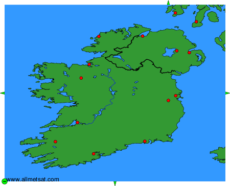
To change the map : click on the green buttons with a black cross to zoom in, on the green button with a dash to zoom out, or on the green arrows for adjacent maps.


METAR-TAF: