METAR-TAF
Airports :
Visakhapatnam
Aden
Al Ghaydah
Al Mukalla
Alor Setar
Antananarivo
Antsiranana
Ataq
Aurangabad
Bangalore
Bangalore
Bangkok
Bangkok-Suvarnabhumi
Batam
Belgaum
Buriram
Butterworth
Cần Thơ
Chennai
Chiang Mai
Chiang Rai
Christmas Island
Chumphon
Cocos
Coimbatore
Colombo
Diego Garcia
Dzaoudzi
Hambantota
Hargeisa
Hat Yai
Hua Hin
Hyderabad
Hyderabad
Ibb
Île Sainte-Marie
Ipoh
Johor Bahru
Kerteh
Khon Kaen
Kochi
Ko Samui
Kota Bharu
Kozhikode
Krabi
Kuala Lumpur
Kuala Terengganu
Kuantan
Lampang
Langkawi
Loei
Luang Prabang
Madurai
Mae Hong Son
Mae Sot
Mahajanga
Malé
Mangalore
Mauritius
Medan
Melaka
Mersing
Mogadishu
Mumbai
Mumbai
Mysore
Najran
Nakhon Phanom
Nakhon Ratchasima
Nakhon Si Thammarat
Nan
Narathiwat
Nosy Be
Padang
Pakxe
Palembang
Panaji
Pattani
Pattaya-Rayong
Pekanbaru
Penang
Phetchabun
Phitsanulok
Phnom Penh
Phrae
Phuket
Phú Quốc
Praslin
Rajahmundry
Ranong
Rodrigues
Roi Et
Saint-Denis
Saint-Pierre
Sakon Nakhon
Salalah
Sana'a
Savannakhet
Seiyun
Sharurah
Siem Reap
Singapore-Changi
Singapore-Paya Lebar
Singapore-Seletar
Sitiawan
Socotra
Songkhla
Subang Jaya
Sukhothai
Surat Thani
Tak
Thiruvananthapuram
Thoothukudi
Tiruchirapalli
Tirupati
Toamasina
Tôlanaro
Trang
Trat
Ubon Ratchathani
Udon Thani
Victoria
Vientiane
Vijayawada
Visakhapatnam
Yangon
Indian Ocean islands
Bahrain
Bali
Bangladesh
Bhutan
Cambodia
China, East
Comoros
Djibouti
Eritrea
Ethiopia
India
Indian Ocean
India, Northeast
Indonesia
Java
Laos
Madagascar
Malaysia
Mauritius
Mozambique
Myanmar
Nepal
Oman
Qatar
Réunion
Saudi Arabia
Singapore
Sri Lanka
Thailand
United Arab Emirates
Vietnam
Yemen
Visakhapatnam Airport Visakhapatnam, India
latitude: 17-43-16N, longitude: 83-13-28E, elevation: 6 m
Current weather observation The report was made 16 minutes ago, at 08:00 UTC
Wind 10 kt from the East
Temperature 27 °C
Humidity 70 %
Pressure 1013 hPa
Visibility: 2500 m
Few clouds at a height of 1800 ft
haze
METAR: VOVZ 020800Z 09010KT 2500 HZ FEW018 27/21 Q1013 NOSIG
Time: 13:46 (08:16 UTC) Forecast The report was made 16 minutes ago, at 08:00 UTC
Forecast valid from 02 at 09 UTC to 02 at 18 UTC
Wind 10 kt from the East/Northeast
Visibility: 2500 m
Few clouds at a height of 1800 ft
haze
Becoming
Wind 2 kt from variable directions
TAF: VOVZ 020800Z 0209/0218 07010KT 2500 HZ FEW018 BECMG 0215/0217 VRB02KT
Weather observations and forecasts of more than 4000 airports (METAR and TAF reports).
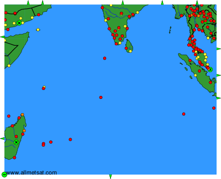
The available stations are represented by yellow and red dots on the map.
Hover mouse over dot to see the name of the station.
Then click to see weather observations and forecasts.
To change the map : click on the green buttons with a black cross to zoom in, on the green button with a dash to zoom out, or on the green arrows for adjacent maps.
