METAR-TAF
Airports :
Ramon Airport
Eilat, Israel
latitude: 29-43-25N, longitude: 35-00-41E, elevation: 88 m
Current weather observation
The report was made 46 minutes ago, at 20:50 UTC
Wind 15 kt from the North
Temperature 26°C
Humidity 37%
Pressure 1013 hPa
Visibility 10 km or more
no clouds below 1500 m and no cumulonimbus
METAR: LLER 222050Z AUTO 01015KT CAVOK 26/10 Q1013
Time: 00:36 (21:36 UTC)
Forecast
The report was made 4 hours and 34 minutes ago, at 17:02 UTC
Forecast valid from 22 at 18 UTC to 23 at 18 UTC
Wind 10 kt from the North
Visibility 10 km or more
no clouds below 1500 m and no cumulonimbus
Becoming
from 23 at 07 UTC to 23 at 09 UTC
from 23 at 07 UTC to 23 at 09 UTC
Wind 15 kt from the North/Northeast
TAF: LLER 221702Z 2218/2318 35010KT CAVOK TX33/2312Z TN20/2304Z BECMG 2307/2309 02015KT
Weather observations and forecasts of more than 4000 airports (METAR and TAF reports).
The available stations are represented by yellow and red dots on the map.
Hover mouse over dot to see the name of the station.
Then click to see weather observations and forecasts.
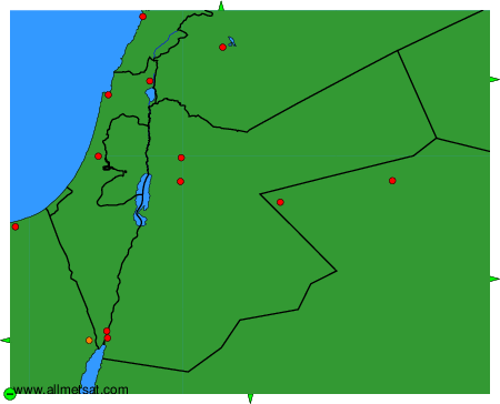
To change the map : click on the green buttons with a black cross to zoom in, on the green button with a dash to zoom out, or on the green arrows for adjacent maps.