METAR-TAF
Airports :
Queen Alia International Airport
Amman-Queen Alia, Jordan
latitude: 31-40N, longitude: 035-58E, elevation: 721 m
Current weather observation
The report was made 1 hour and 12 minutes ago, at 06:00 UTC
Wind 4 kt from the Northwest
Temperature 14°C
Humidity 67%
Pressure 1003 hPa
Visibility: 4000 m
Broken clouds at a height of 3000 ft
haze
METAR: OJAI 190600Z 32004KT 4000 HZ BKN030 14/08 Q1003 NOSIG
Time: 09:12 (07:12 UTC)
Forecast
The report was made 2 hours and 12 minutes ago, at 05:00 UTC
Forecast valid from 19 at 06 UTC to 20 at 12 UTC
Wind 18 kt from the West
Visibility: 4000 m
Scattered clouds at a height of 2500 ft, Towering cumulus.
Scattered clouds at a height of 3000 ft
Scattered clouds at a height of 3000 ft
rain, mist
Probability 40% :
Temporary
from 19 at 12 UTC to 19 at 18 UTC
from 19 at 12 UTC to 19 at 18 UTC
Wind 18 kt from the West with gusts up to 28 kt
Visibility: 1500 m
Few clouds at a height of 2000 ft, Cumulonimbus.
Broken clouds at a height of 2500 ft, Towering cumulus.
Broken clouds at a height of 2500 ft, Towering cumulus.
thunderstorm, rain, hail
Probability 40%
from 20 at 01 UTC to 20 at 07 UTC
from 20 at 01 UTC to 20 at 07 UTC
Visibility: 0500 m
fog,
TAF: OJAI 190500Z 1906/2012 26018KT 4000 RA BR SCT025TCU SCT030 PROB40 TEMPO 1912/1918 27018G28KT 1500 TSRAGR FEW020CB BKN025TCU PROB40 2001/2007 0500 FG
Weather observations and forecasts of more than 4000 airports (METAR and TAF reports).
The available stations are represented by yellow and red dots on the map.
Hover mouse over dot to see the name of the station.
Then click to see weather observations and forecasts.
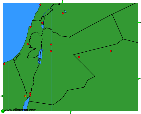
To change the map : click on the green buttons with a black cross to zoom in, on the green button with a dash to zoom out, or on the green arrows for adjacent maps.