METAR-TAF
Airports :
Damascus International Airport
Damascus, Syria
latitude: 33-25N, longitude: 036-31E, elevation: 608 m
Current weather observation
The report was made 1 hour and 1 minutes ago, at 03:00 UTC
Wind 4 kt from the North
Temperature 1°C
Humidity 75%
Pressure 1017 hPa
Visibility 10 km or more
no clouds below 1500 m and no cumulonimbus
METAR: OSDI 070300Z 36004KT CAVOK 01/M03 Q1017
Time: 06:01 (04:01 UTC)
Forecast
The report was made 6 hours and 1 minutes ago, at 22:00 UTC
Forecast valid from 07 at 00 UTC to 08 at 06 UTC
Wind 5 kt from the South/Southwest
Visibility 10 km or more
no clouds below 1500 m and no cumulonimbus
Temporary
from 07 at 15 UTC to 07 at 18 UTC
from 07 at 15 UTC to 07 at 18 UTC
Wind 14 kt from the West/Southwest with gusts up to 28 kt
Few clouds at a height of 3000 ft
Scattered clouds at a height of 10000 ft
Scattered clouds at a height of 10000 ft
light rain
TAF: OSDI 062200Z 0700/0806 21005KT CAVOK TEMPO 0715/0718 25014G28KT -RA FEW030 SCT100
Weather observations and forecasts of more than 4000 airports (METAR and TAF reports).
The available stations are represented by yellow and red dots on the map.
Hover mouse over dot to see the name of the station.
Then click to see weather observations and forecasts.
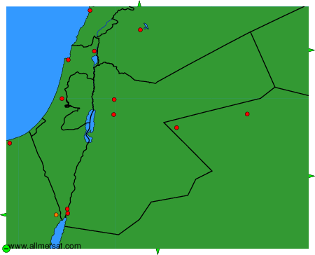
To change the map : click on the green buttons with a black cross to zoom in, on the green button with a dash to zoom out, or on the green arrows for adjacent maps.