METAR-TAF
Airports :
Budapest
Aigen im Ennstal
Ajaccio
Albenga
Alghero
Alpnach
Altenstadt
Ancona
Andora
Annaba
Annecy
Aviano
Bad Vöslau
Banja Luka
Bari
Basel-Mulhouse
Bastia
Batajnica
Belgrade
Bergamo
Berne
Bizerte
Bologna
Bolzano
Brač
Brescia
Brescia Ghedi
Brindisi
Budapest
Buochs
Cagliari
Calvi
Cannes
Capri
Castrignano del Capo
Catania
Cerklje ob Krki
Cervia
Chambery / Aix-Les-Bains
Comiso
Constantine
Corfu
Crotone
Cuneo
Decimomannu
Dornbirn
Dübendorf
Dubrovnik
Emmen
Ferrara
Figari
Florence
Foggia
Foggia
Forlì
Friedrichshafen
Frontone
Frosinone
Geneva
Genoa
Gioia del Colle
Graz
Grazzanise
Grenchen
Grosseto
Guidonia Montecelio
Győr
Hammamet
Hévíz
Innsbruck
Jendouba
Jijel
Kecskemét
Kefalonia
Kelibia
Klagenfurt
La Chaux-de-Fonds
Lamezia Terme
Latina
Lecce
Le Luc
Ljubljana
Locarno
Lugano
Luxeuil-les-Bains
Maribor
Meiringen
Memmingen
Messina
Milan-Linate
Milan-Malpensa
Monte Argentario
Monte Cimone
Monte Scuro
Monte Terminillo
Mostar
Naples
Nice
Novara
Olbia
Osijek
Padua
Paganella
Palermo
Pantelleria
Pápa
Parma
Passo dei Giovi
Passo della Cisa
Passo Rolle
Payerne
Pécs
Perugia
Pescara
Piacenza
Pian Rosa
Pisa
Podgorica
Portorož
Pratica Di Mare
Prato Nevoso
Pula
Reggio Calabria
Resia Pass
Rieti
Rijeka
Rimini
Rome
Rome Ciampino
Rome-Fiumicino
Salerno
Salzburg
Sarajevo
Sarzana
Sigonella
Sion
Solenzara
Split
St. Gallen
St. Moritz
Szeged
Szolnok
Tabarka
Taranto
Tarvisio
Tirana
Tivat
Toblach
Tortolì
Toulon
Trapani
Trevico
Treviso
Treviso
Trieste
Trieste / Ronchi dei Legionari
Tunis
Turin-Aeritalia
Turin-Bric della Croce
Turin-Caselle
Tuzla
Udine
Užice
Venice
Verona
Viterbo
Wiener Neustadt
Zadar
Zagreb
Zell am See
Zeltweg
Zürich
Italy
Albania
Algeria, North
Austria
Bosnia and Herzegovina
Bulgaria
Croatia
Czech Republic
Europe
France
Germany
Greece
Hungary
Italy, North
Libya
Macedonia
Montenegro
Romania
Serbia
Slovakia
Slovenia
Spain
Switzerland
Tunisia
Budapest Ferenc Liszt International Airport Budapest, Hungary
latitude: 47-26N, longitude: 019-16E, elevation: 151 m
Current weather observation The report was made 7 minutes ago, at 11:30 UTC
Wind 6 kt from the East/Southeast , varying between East/Northeast and South
Temperature 34 °C
Humidity 23 %
Pressure 1020 hPa
Visibility 10 km or more
no clouds below 1500 m and no cumulonimbus
METAR: LHBP 301130Z 11006KT 060V170 CAVOK 34/10 Q1020 NOSIG
Time: 13:37 (11:37 UTC) Forecast The report was made 22 minutes ago, at 11:15 UTC
Forecast valid from 30 at 12 UTC to 31 at 12 UTC
Wind 3 kt from variable directions
Visibility 10 km or more
no clouds below 1500 m and no cumulonimbus
Temporary
Wind 8 kt from the Southeast
Temporary
Wind 8 kt from the Southeast
TAF: LHBP 301115Z 3012/3112 VRB03KT CAVOK TEMPO 3012/3020 13008KT TEMPO 3109/3112 13008KT
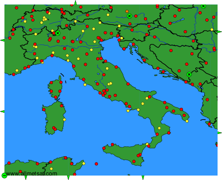
Weather observations and forecasts of more than 4000 airports (METAR and TAF reports).
The available stations are represented by yellow and red dots on the map.
Hover mouse over dot to see the name of the station.
Then click to see weather observations and forecasts.
To change the map : click on the green buttons with a black cross to zoom in, on the green button with a dash to zoom out, or on the green arrows for adjacent maps.