METAR-TAF
Airports :
Sarajevo International Airport
Sarajevo, Bosnia and Herzegovina
latitude: 43-49N, longitude: 018-20E, elevation: 511 m
Current weather observation
The report was made 28 minutes ago, at 04:00 UTC
Calm wind
Temperature 6°C
Humidity 100%
Pressure 1025 hPa
Visibility 10 km or more
Broken clouds at a height of 4500 ft
METAR: LQSA 050400Z 00000KT 9999 BKN045 06/06 Q1025
Time: 05:28 (04:28 UTC)
Forecast
The report was made 5 hours and 28 minutes ago, at 23:00 UTC
Forecast valid from 05 at 00 UTC to 05 at 24 UTC
Wind 2 kt from variable directions
Visibility 10 km or more
Broken clouds at a height of 5000 ft
Probability 30% :
Temporary
from 05 at 00 UTC to 05 at 06 UTC
from 05 at 00 UTC to 05 at 06 UTC
Few clouds at a height of 1800 ft
Few clouds at a height of 3000 ft, Towering cumulus.
Broken clouds at a height of 4500 ft
Few clouds at a height of 3000 ft, Towering cumulus.
Broken clouds at a height of 4500 ft
rain showers
Probability 40% :
Temporary
from 05 at 12 UTC to 05 at 18 UTC
from 05 at 12 UTC to 05 at 18 UTC
Wind 10 kt from the North/Northwest
TAF: LQSA 042300Z 0500/0524 VRB02KT 9999 BKN050 TX13/0514Z TN02/0505Z PROB30 TEMPO 0500/0506 SHRA FEW018 FEW030TCU BKN045 PROB40 TEMPO 0512/0518 33010KT
Weather observations and forecasts of more than 4000 airports (METAR and TAF reports).
The available stations are represented by yellow and red dots on the map.
Hover mouse over dot to see the name of the station.
Then click to see weather observations and forecasts.
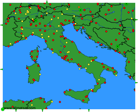
To change the map : click on the green buttons with a black cross to zoom in, on the green button with a dash to zoom out, or on the green arrows for adjacent maps.