METAR-TAF
Airports :
Batajnica Air Base
Batajnica, Serbia
latitude: 44-56-07N, longitude: 020-15-27E, elevation: 86 m
Current weather observation
The report was made 22 minutes ago, at 10:00 UTC
Wind 4 kt from the East, varying between North/Northeast and South/Southeast
Temperature 24°C
Humidity 65%
Pressure 1012 hPa
Visibility 10 km or more
no clouds below 1500 m and no cumulonimbus
METAR: LYBT 081000Z 10004KT 020V150 CAVOK 24/17 Q1012 NOSIG
Time: 12:22 (10:22 UTC)
Forecast
The report was made 17 hours and 22 minutes ago, at 17:00 UTC
Forecast valid from 07 at 18 UTC to 08 at 18 UTC
Wind 4 kt from the Southwest
Visibility 10 km or more
Scattered clouds at a height of 4500 ft
Becoming
from 08 at 07 UTC to 08 at 09 UTC
from 08 at 07 UTC to 08 at 09 UTC
Wind 10 kt from the North
Becoming
from 08 at 14 UTC to 08 at 16 UTC
from 08 at 14 UTC to 08 at 16 UTC
Wind 6 kt from the West
Probability 40% :
Temporary
from 08 at 14 UTC to 08 at 18 UTC
from 08 at 14 UTC to 08 at 18 UTC
Visibility: 5000 m
Scattered clouds at a height of 3000 ft, Towering cumulus.
Scattered clouds at a height of 4000 ft
Scattered clouds at a height of 4000 ft
rain showers
TAF: LYBT 071700Z 0718/0818 22004KT 9999 SCT045 TX26/0718Z TN17/0803Z BECMG 0807/0809 36010KT BECMG 0814/0816 28006KT PROB40 TEMPO 0814/0818 5000 SHRA SCT030TCU SCT040
Weather observations and forecasts of more than 4000 airports (METAR and TAF reports).
The available stations are represented by yellow and red dots on the map.
Hover mouse over dot to see the name of the station.
Then click to see weather observations and forecasts.
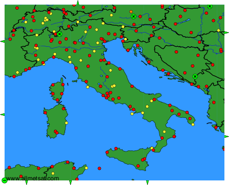
To change the map : click on the green buttons with a black cross to zoom in, on the green button with a dash to zoom out, or on the green arrows for adjacent maps.