METAR-TAF
Airports :
Bouaké Airport
Bouaké, Ivory coast
latitude: 07-44N, longitude: 005-04W, elevation: 376 m
METAR: missing
Time: 05:00 (05:00 UTC)
Forecast
The report was made 6 hours and 0 minutes ago, at 23:00 UTC
Forecast valid from 29 at 00 UTC to 29 at 24 UTC
Wind 8 kt from the Southwest
Visibility: 8000 m
Few clouds at a height of 1200 ft
Probability 30% :
Temporary
from 29 at 04 UTC to 29 at 10 UTC
from 29 at 04 UTC to 29 at 10 UTC
Visibility: 4000 m
Broken clouds at a height of 1100 ft
Few clouds at a height of 2000 ft, Cumulonimbus.
Few clouds at a height of 2000 ft, Cumulonimbus.
thunderstorm, rain
Probability 40%
from 29 at 10 UTC to 29 at 16 UTC
from 29 at 10 UTC to 29 at 16 UTC
Broken clouds at a height of 1300 ft
TAF: DIBK 282300Z 2900/2924 22008KT 8000 FEW012 PROB30 TEMPO 2904/2910 4000 TSRA BKN011 FEW020CB PROB40 2910/2916 BKN013
Weather observations and forecasts of more than 4000 airports (METAR and TAF reports).
The available stations are represented by yellow and red dots on the map.
Hover mouse over dot to see the name of the station.
Then click to see weather observations and forecasts.
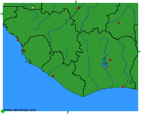
To change the map : click on the green buttons with a black cross to zoom in, on the green button with a dash to zoom out, or on the green arrows for adjacent maps.