METAR-TAF
Airports :
Yamoussoukro Airport
Yamoussoukro, Ivory coast
latitude: 06-54N, longitude: 005-21W, elevation: 196 m
METAR: missing
Time: 12:29 (12:29 UTC)
Forecast
The report was made 1 hour and 29 minutes ago, at 11:00 UTC
Forecast valid from 08 at 12 UTC to 09 at 12 UTC
Wind 6 kt from the West/Southwest
Visibility: 8000 m
Broken clouds at a height of 1300 ft
Becoming
from 08 at 16 UTC to 08 at 17 UTC
from 08 at 16 UTC to 08 at 17 UTC
Scattered clouds at a height of 1200 ft
Probability 30% :
Temporary
from 08 at 17 UTC to 08 at 21 UTC
from 08 at 17 UTC to 08 at 21 UTC
Broken clouds at a height of 1200 ft
Few clouds at a height of 2000 ft, Cumulonimbus.
Few clouds at a height of 2000 ft, Cumulonimbus.
thunderstorm
TAF: DIYO 081100Z 0812/0912 24006KT 8000 BKN013 BECMG 0816/0817 SCT012 PROB30 TEMPO 0817/0821 TS BKN012 FEW020CB
Weather observations and forecasts of more than 4000 airports (METAR and TAF reports).
The available stations are represented by yellow and red dots on the map.
Hover mouse over dot to see the name of the station.
Then click to see weather observations and forecasts.
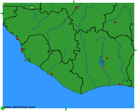
To change the map : click on the green buttons with a black cross to zoom in, on the green button with a dash to zoom out, or on the green arrows for adjacent maps.