METAR-TAF
Airports :
Bamako–Modibo Keïta International Airport
Bamako, Mali
latitude: 12-32N, longitude: 007-57W, elevation: 380 m
Current weather observation
METAR: GABS 230200Z 00000KT 8000 FEW016 25/25 Q1014 NOSIG
Time: 02:37 (02:37 UTC)
Forecast
from 23 at 02 UTC to 23 at 08 UTC
Few clouds at a height of 3000 ft, Cumulonimbus.
from 23 at 14 UTC to 23 at 16 UTC
Few clouds at a height of 3000 ft, Cumulonimbus.
from 23 at 16 UTC to 23 at 22 UTC
Scattered clouds at a height of 3000 ft, Cumulonimbus.
from 23 at 22 UTC to 24 at 03 UTC
Few clouds at a height of 3000 ft, Cumulonimbus.
TAF: GABS 222325Z 2300/2406 VRB06KT 8000 FEW016 PROB30 TEMPO 2302/2308 02020G30KT 3000 TSRA SCT016 FEW030CB PROB40 TEMPO 2314/2316 VRB18G30KT 4500 TSRA BKN016 FEW030CB TEMPO 2316/2322 10025G45KT 4000 TSRA BKN016 SCT030CB PROB40 TEMPO 2322/2403 4500 TS SHRA BKN016 FEW030CB
Weather observations and forecasts of more than 4000 airports (METAR and TAF reports).
The available stations are represented by yellow and red dots on the map.
Hover mouse over dot to see the name of the station.
Then click to see weather observations and forecasts.
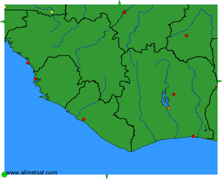
To change the map : click on the green buttons with a black cross to zoom in, on the green button with a dash to zoom out, or on the green arrows for adjacent maps.