METAR-TAF
Airports :
Roberts International Airport
Monrovia, Liberia
latitude: 06-15N, longitude: 010-21W, elevation: 18 m
Current weather observation
The report was made 48 minutes ago, at 01:00 UTC
Wind 3 kt from the North/Northeast
Temperature 24°C
Humidity 94%
Pressure 1017 hPa
Visibility 10 km or more
Scattered clouds at a height of 1100 ft
METAR: GLRB 160100Z 03003KT 9999 SCT011 24/23 Q1017 NOSIG
Time: 01:48 (01:48 UTC)
Forecast
The report was made 14 hours and 48 minutes ago, at 11:00 UTC
Forecast valid from 15 at 12 UTC to 16 at 12 UTC
Wind 10 kt from the West
Visibility: 9000 m
Few clouds at a height of 2500 ft, Cumulonimbus.
Becoming
from 15 at 13 UTC to 15 at 15 UTC
from 15 at 13 UTC to 15 at 15 UTC
Visibility: 7000 m
Broken clouds at a height of 1500 ft
Few clouds at a height of 2400 ft, Cumulonimbus.
Few clouds at a height of 2400 ft, Cumulonimbus.
light drizzle
Temporary
from 15 at 16 UTC to 15 at 20 UTC
from 15 at 16 UTC to 15 at 20 UTC
Wind 6 kt from the South
Visibility: 5000 m
Broken clouds at a height of 1400 ft
thunderstorm, rain
TAF: GLRB 151100Z 1512/1612 26010KT 9000 BKNO16 FEW025CB BECMG 1513/1515 7000 -DZ BKN015 FEW024CB TEMPO 1516/1520 18006KT 5000 TSRA BKN014 FEW024CB-
Weather observations and forecasts of more than 4000 airports (METAR and TAF reports).
The available stations are represented by yellow and red dots on the map.
Hover mouse over dot to see the name of the station.
Then click to see weather observations and forecasts.
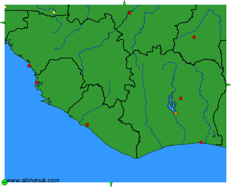
To change the map : click on the green buttons with a black cross to zoom in, on the green button with a dash to zoom out, or on the green arrows for adjacent maps.