METAR-TAF
Airports :
Tokachi–Obihiro Airport
Obihiro, Japan
latitude: 42-44N, longitude: 143-13E, elevation: 149 m
Current weather observation
The report was made 10 minutes ago, at 07:00 UTC
Wind 12 kt from the South
Temperature 22°C
Humidity 73%
Pressure 1014 hPa
Visibility 10 km or more
Few clouds at a height of 2000 ft
METAR: RJCB 270700Z 17012KT 9999 FEW020 22/17 Q1014
Time: 16:10 (07:10 UTC)
Forecast
The report was made 2 hours and 5 minutes ago, at 05:05 UTC
Forecast valid from 27 at 06 UTC to 28 at 12 UTC
Wind 10 kt from the South/Southeast
Visibility 10 km or more
Few clouds at a height of 2000 ft
Broken clouds at a height of 4000 ft
Broken clouds at a height of 4000 ft
Becoming
from 27 at 11 UTC to 27 at 13 UTC
from 27 at 11 UTC to 27 at 13 UTC
Wind 4 kt from the North
Becoming
from 27 at 18 UTC to 27 at 21 UTC
from 27 at 18 UTC to 27 at 21 UTC
Wind 5 kt from the South/Southeast
TAF: RJCB 270505Z 2706/2812 16010KT 9999 FEW020 BKN040 BECMG 2711/2713 35004KT BECMG 2718/2721 16005KT
Weather observations and forecasts of more than 4000 airports (METAR and TAF reports).
The available stations are represented by yellow and red dots on the map.
Hover mouse over dot to see the name of the station.
Then click to see weather observations and forecasts.
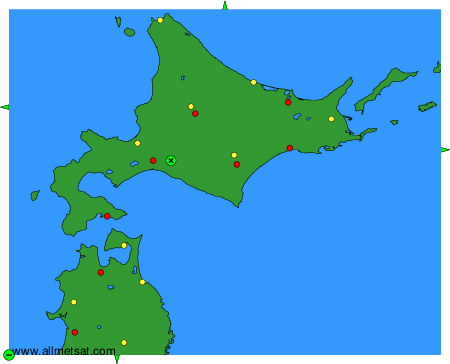
To change the map : click on the green buttons with a black cross to zoom in, on the green button with a dash to zoom out, or on the green arrows for adjacent maps.