METAR-TAF
Airports :
Hanamaki Airport
Hanamaki, Japan
latitude: 39-26N, longitude: 141-08E, elevation: 90 m
Current weather observation
The report was made 9 hours and 29 minutes ago, at 10:00 UTC
Wind 5 kt from the South/Southeast, varying between East and South
Temperature 23°C
Humidity 100%
Pressure 1005 hPa
Visibility 10 km or more
Few clouds at a height of 400 ft
Scattered clouds at a height of 2000 ft
Broken clouds at a height of 3000 ft
Scattered clouds at a height of 2000 ft
Broken clouds at a height of 3000 ft
light rain showers
METAR: RJSI 121000Z 15005KT 100V180 9999 -SHRA FEW004 SCT020 BKN030 23/23 Q1005
Time: 04:29 (19:29 UTC)
Forecast
The report was made 2 hours and 24 minutes ago, at 17:05 UTC
Forecast valid from 12 at 18 UTC to 14 at 00 UTC
Wind 4 kt from the West/Southwest
Visibility 10 km or more
Few clouds at a height of 1500 ft
Broken clouds at a height of 3000 ft
Broken clouds at a height of 3000 ft
Becoming
from 12 at 18 UTC to 12 at 20 UTC
from 12 at 18 UTC to 12 at 20 UTC
Wind 6 kt from the North/Northeast
Becoming
from 13 at 04 UTC to 13 at 06 UTC
from 13 at 04 UTC to 13 at 06 UTC
Wind 10 kt from the West/Northwest
Becoming
from 13 at 12 UTC to 13 at 15 UTC
from 13 at 12 UTC to 13 at 15 UTC
Wind 4 kt from the North/Northeast
TAF: RJSI 121705Z 1218/1400 25004KT 9999 FEW015 BKN030 BECMG 1218/1220 02006KT BECMG 1304/1306 29010KT BECMG 1312/1315 02004KT
Weather observations and forecasts of more than 4000 airports (METAR and TAF reports).
The available stations are represented by yellow and red dots on the map.
Hover mouse over dot to see the name of the station.
Then click to see weather observations and forecasts.
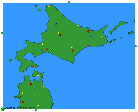
To change the map : click on the green buttons with a black cross to zoom in, on the green button with a dash to zoom out, or on the green arrows for adjacent maps.