METAR-TAF
Airports :
Toyama Airport
Toyama, Japan
latitude: 36-39N, longitude: 137-11E, elevation: 24 m
Current weather observation
The report was made 43 minutes ago, at 02:00 UTC
Wind 8 kt from the North
Temperature 23°C
Humidity 78%
Pressure 1009 hPa
Visibility 10 km or more
Few clouds at a height of 1200 ft
Broken clouds at a height of 2000 ft
Broken clouds at a height of 2000 ft
METAR: RJNT 280200Z 36008KT 9999 FEW012 BKN020 23/19 Q1009
Time: 11:43 (02:43 UTC)
Forecast
The report was made 3 hours and 38 minutes ago, at 23:05 UTC
Forecast valid from 28 at 00 UTC to 29 at 06 UTC
Wind 10 kt from the North
Visibility 10 km or more
Few clouds at a height of 3000 ft
Scattered clouds at a height of 7000 ft
Scattered clouds at a height of 7000 ft
Becoming
from 28 at 12 UTC to 28 at 15 UTC
from 28 at 12 UTC to 28 at 15 UTC
Wind 4 kt from the West/Southwest
Becoming
from 29 at 00 UTC to 29 at 03 UTC
from 29 at 00 UTC to 29 at 03 UTC
Wind 10 kt from the North
TAF: RJNT 272305Z 2800/2906 36010KT 9999 FEW030 SCT070 BECMG 2812/2815 24004KT BECMG 2900/2903 36010KT
Weather observations and forecasts of more than 4000 airports (METAR and TAF reports).
The available stations are represented by yellow and red dots on the map.
Hover mouse over dot to see the name of the station.
Then click to see weather observations and forecasts.
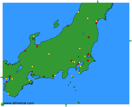
To change the map : click on the green buttons with a black cross to zoom in, on the green button with a dash to zoom out, or on the green arrows for adjacent maps.