METAR-TAF
Airports :
Ibaraki Airport
Hyakuri, Japan
latitude: 36-11N, longitude: 140-25E, elevation: 32 m
Current weather observation
Broken clouds at a height of 800 ft
METAR: RJAH 260900Z 07009KT 9999 FEW007 BKN008 25/24 Q1008
Time: 18:26 (09:26 UTC)
Forecast
Broken clouds at a height of 1200 ft
from 26 at 06 UTC to 26 at 09 UTC
Broken clouds at a height of 1500 ft
Few clouds at a height of 1500 ft, Cumulonimbus.
from 26 at 09 UTC to 26 at 15 UTC
Broken clouds at a height of 300 ft
Few clouds at a height of 1200 ft, Cumulonimbus.
from 26 at 15 UTC to 26 at 18 UTC
Broken clouds at a height of 300 ft
from 27 at 00 UTC to 27 at 03 UTC
TAF: RJAH 260505Z 2606/2712 03006KT 6000 -SHRA FEW003 BKN012 TEMPO 2606/2609 TS FEW008 BKN015 FEW015CB TEMPO 2609/2615 3000 TSRA BR FEW001 BKN003 FEW012CB TEMPO 2615/2618 3000 BR FEW001 BKN003 BECMG 2700/2703 06016KT
Weather observations and forecasts of more than 4000 airports (METAR and TAF reports).
The available stations are represented by yellow and red dots on the map.
Hover mouse over dot to see the name of the station.
Then click to see weather observations and forecasts.
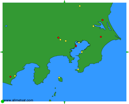
To change the map : click on the green buttons with a black cross to zoom in, on the green button with a dash to zoom out, or on the green arrows for adjacent maps.