METAR-TAF
Airports :
Akita Airport
Akita, Japan
latitude: 39-37N, longitude: 140-13E, elevation: 93 m
Current weather observation
The report was made 21 minutes ago, at 01:00 UTC
Wind 10 kt from the West
Temperature 27°C
Humidity 79%
Pressure 1002 hPa
Visibility 10 km or more
Few clouds at a height of 500 ft
Scattered clouds at a height of 1000 ft
Broken clouds at a height of 2500 ft
Scattered clouds at a height of 1000 ft
Broken clouds at a height of 2500 ft
METAR: RJSK 300100Z 27010KT 9999 FEW005 SCT010 BKN025 27/23 Q1002
Time: 10:21 (01:21 UTC)
Forecast
The report was made 2 hours and 13 minutes ago, at 23:08 UTC
Forecast valid from 30 at 00 UTC to 31 at 06 UTC
Wind 10 kt from the West
Visibility 10 km or more
Few clouds at a height of 1000 ft
Broken clouds at a height of 2000 ft
Broken clouds at a height of 2000 ft
Temporary
from 30 at 12 UTC to 30 at 18 UTC
from 30 at 12 UTC to 30 at 18 UTC
Few clouds at a height of 500 ft
Broken clouds at a height of 800 ft
Broken clouds at a height of 800 ft
TAF: RJSK 292308Z 3000/3106 28010KT 9999 FEW010 BKN020 TEMPO 3012/3018 FEW005 BKN008
Weather observations and forecasts of more than 4000 airports (METAR and TAF reports).
The available stations are represented by yellow and red dots on the map.
Hover mouse over dot to see the name of the station.
Then click to see weather observations and forecasts.
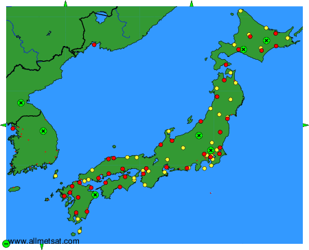
To change the map : click on the green buttons with a black cross to zoom in, on the green button with a dash to zoom out, or on the green arrows for adjacent maps.