METAR-TAF
Airports :
Halim Perdanakusuma International Airport
East Jakarta, Indonesia
latitude: 06-15-59S, longitude: 106-53-28E, elevation: 25 m
Current weather observation
The report was made 4 hours and 28 minutes ago, at 16:00 UTC
Wind 4 kt from the West/Southwest
Temperature 26°C
Humidity 84%
Pressure 1012 hPa
Visibility: 7000 m
Scattered clouds at a height of 2000 ft
METAR: WIHH 011600Z 24004KT 7000 SCT020 26/23 Q1012 RMK RA TO NE
Time: 03:28 (20:28 UTC)
Forecast
The report was made 3 hours and 28 minutes ago, at 17:00 UTC
Forecast valid from 01 at 18 UTC to 02 at 18 UTC
Wind 6 kt from the South/Southwest
Visibility: 6000 m
Scattered clouds at a height of 2000 ft
Temporary
from 02 at 07 UTC to 02 at 10 UTC
from 02 at 07 UTC to 02 at 10 UTC
Wind 13 kt from the Northeast
Visibility: 3000 m
Few clouds at a height of 1600 ft, Cumulonimbus.
Broken clouds at a height of 1800 ft
Broken clouds at a height of 1800 ft
thunderstorm, light rain,
TAF: WIHH 011700Z 0118/0218 21006KT 6000 SCT020 TEMPO 0207/0210 05013KT 3000 -TSRA FEW016CB BKN018
Weather observations and forecasts of more than 4000 airports (METAR and TAF reports).
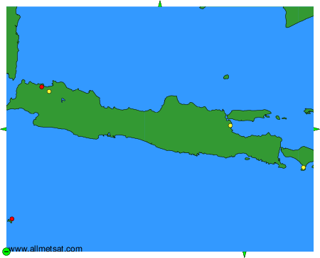
The available stations are represented by yellow and red dots on the map.
Hover mouse over dot to see the name of the station.
Then click to see weather observations and forecasts.
To change the map : click on the green buttons with a black cross to zoom in, on the green button with a dash to zoom out, or on the green arrows for adjacent maps.