METAR-TAF
Airports :
Manhattan
Albion
Alva
Atlantic
Audubon
Aurora
Bartlesville
Beatrice
Broken Bow
Burlington
Carroll
Chanute
Claremore
Clarinda
Coffeyville
Colby
Columbus
Concordia
Council Bluffs
Denison
Dodge City
El Dorado
Elkhart
Emporia
Enid
Falls City
Fort Riley
Fremont
Gage
Garden City
Goodland
Grand Island
Great Bend
Grove
Guymon
Harlan
Hastings
Hays
Hebron
Hill City
Holdrege
Hugoton
Hutchinson
Imperial
Independence
Joplin
Kansas City
Kansas City
Kearney
Lawrence
Lexington
Liberal
Lincoln
Manhattan
McCook
Medicine Lodge
Nebraska City
Newton
Norfolk
North Platte
Ogallala
Olathe
Olathe
Omaha
Omaha
Omaha
O'Neill
Ord
Ottawa
Parsons
Perryton
Pittsburg
Ponca City
Pratt
Red Oak
Russell
Saint Joseph
Salina
Shenandoah
Siloam Springs
Sioux City
Stanton County
St. Francis
Stillwater
Tekamah
Thedford
Topeka
Topeka
Tulsa
Vance Air Force Base
Wahoo
Wichita
Wichita
Wichita
Winfield / Arkansas City
Woodward
York
Kansas
Arkansas
Colorado
Iowa
Missouri
Nebraska
New Mexico
North America
Oklahoma
Texas, West
Manhattan Regional Airport Manhattan, Kansas, United States
latitude: 39-08-07N, longitude: 096-40-40W, elevation: 1053 ft
Current weather observation The report was made 1 hour and 5 minutes ago, at 02:54 UTC
Wind 3 mph from the South/Southwest
Temperature 32 °F
Humidity 86 %
Pressure 29.74 in. Hg
Visibility: 10 miles
Clear sky
METAR: KMHK 160254Z COR 21003KT 10SM CLR 00/M02 A2974
Time: 21:59 (03:59 UTC) Forecast The report was made 4 hours and 39 minutes ago, at 23:20 UTC
Forecast valid from 16 at 00 UTC to 16 at 24 UTC
Wind 9 mph from the West/Southwest
Visibility: 6 miles
Scattered clouds at a height of 22000 ft
From 16 at 0700 UTC
Wind 7 mph from the Northwest
Visibility: 6 miles
Broken clouds at a height of 16000 ft
From 16 at 1200 UTC
Wind 13 mph from the West/Northwest with gusts up to 26 mph
Visibility: 6 miles
Few clouds at a height of 25000 ft
From 16 at 1500 UTC
Wind 16 mph from the West/Northwest with gusts up to 32 mph
Visibility: 6 miles
Few clouds at a height of 15000 ft
Probability 30% from 16 at 22 UTC to 16 at 24 UTC
Visibility: 4 miles
Overcast at a height of 2500 ft
light snow showers
TAF: KMHK 152320Z 1600/1624 25008KT P6SM SCT220 FM160700 32006KT P6SM BKN160 FM161200 30011G23KT P6SM FEW250 FM161500 30014G28KT P6SM FEW150 PROB30 1622/1624 4SM -SHSN OVC025
Weather observations and forecasts of more than 4000 airports (METAR and TAF reports).
The available stations are represented by yellow and red dots on the map.
Hover mouse over dot to see the name of the station.
Then click to see weather observations and forecasts.
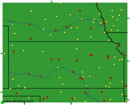
To change the map : click on the green buttons with a black cross to zoom in, on the green button with a dash to zoom out, or on the green arrows for adjacent maps.