METAR-TAF
Airports :
Eldoret International Airport
Eldoret, Kenya
latitude: 00-32N, longitude: 035-17E, elevation: 6954 ft
Current weather observation
Few clouds at a height of 1800 ft, Cumulonimbus.
Broken clouds at a height of 8000 ft
METAR: HKEL 181900Z 17006KT 9999 FEW016 FEW018CB BKN080 15/12 Q1027
Time: 02:15 (23:15 UTC)
Forecast
Broken clouds at a height of 2300 ft
from 18 at 14 UTC to 18 at 18 UTC
Broken clouds at a height of 2000 ft
from 18 at 20 UTC to 18 at 23 UTC
Scattered clouds at a height of 8000 ft
from 19 at 08 UTC to 19 at 11 UTC
from 19 at 13 UTC to 19 at 17 UTC
Broken clouds at a height of 2000 ft
TAF: HKEL 181100Z 1812/1918 30010KT 9999 TS FEW022CB BKN023 TEMPO 1814/1818 TSRA FEW019CB BKN020 BECMG 1820/1823 18005KT NSW FEW018 SCT080 BECMG 1908/1911 33010KT BKN022 TEMPO 1913/1917 -TSRA FEW019CB BKN020
Weather observations and forecasts of more than 4000 airports (METAR and TAF reports).
The available stations are represented by yellow and red dots on the map.
Hover mouse over dot to see the name of the station.
Then click to see weather observations and forecasts.
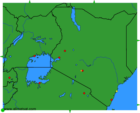
To change the map : click on the green buttons with a black cross to zoom in, on the green button with a dash to zoom out, or on the green arrows for adjacent maps.