METAR-TAF
Airports :
Entebbe International Airport
Entebbe, Uganda
latitude: 00-03N, longitude: 032-27E, elevation: 1155 m
Current weather observation
The report was made 3 hours and 15 minutes ago, at 09:00 UTC
Wind 6 kt from the South/Southeast
Temperature 26°C
Humidity 70%
Pressure 1019 hPa
Visibility 10 km or more
Few clouds at a height of 2300 ft
Few clouds at a height of 2500 ft, Cumulonimbus.
Few clouds at a height of 2500 ft, Cumulonimbus.
METAR: HUEN 130900Z 16006KT 9999 FEW023 FEW025CB 26/20 Q1019 NOSIG
Time: 15:15 (12:15 UTC)
Forecast
The report was made 7 hours and 15 minutes ago, at 05:00 UTC
Forecast valid from 13 at 06 UTC to 14 at 12 UTC
Wind 10 kt from the South
Visibility 10 km or more
Few clouds at a height of 2400 ft
Few clouds at a height of 2600 ft, Cumulonimbus.
Few clouds at a height of 2600 ft, Cumulonimbus.
Becoming
from 13 at 07 UTC to 13 at 09 UTC
from 13 at 07 UTC to 13 at 09 UTC
Wind 9 kt from the Southeast
Visibility: 9000 m
Scattered clouds at a height of 1800 ft
Few clouds at a height of 2000 ft, Cumulonimbus.
Few clouds at a height of 2000 ft, Cumulonimbus.
light rain
TAF: HUEN 130500Z 1306/1412 18010KT 9999 FEW024 FEW026CB BECMG 1307/1309 14009KT 9000 -RA SCT018 FEW020CB
Weather observations and forecasts of more than 4000 airports (METAR and TAF reports).
The available stations are represented by yellow and red dots on the map.
Hover mouse over dot to see the name of the station.
Then click to see weather observations and forecasts.
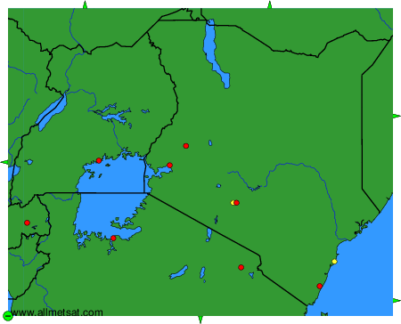
To change the map : click on the green buttons with a black cross to zoom in, on the green button with a dash to zoom out, or on the green arrows for adjacent maps.