METAR-TAF
Airports :
Soroti Airport
Soroti, Uganda
latitude: 01-43N, longitude: 033-37E, elevation: 1132 m
Current weather observation
The report was made 15 hours and 35 minutes ago, at 13:30 UTC
Wind 6 kt from the South/Southwest
Temperature 31°C
Humidity 46%
Pressure 1015 hPa
Visibility 10 km or more
Scattered clouds at a height of 2200 ft
Few clouds at a height of 2400 ft, Cumulonimbus.
Few clouds at a height of 2400 ft, Cumulonimbus.
METAR: HUSO 111330Z 21006KT 9999 SCT022 FEW024CB 31/18 Q1015
Time: 08:05 (05:05 UTC)
Forecast
The report was made 18 hours and 5 minutes ago, at 11:00 UTC
Forecast valid from 11 at 12 UTC to 12 at 12 UTC
Wind 5 kt from the North/Northeast
Visibility 10 km or more
Broken clouds at a height of 2200 ft
Few clouds at a height of 2400 ft, Cumulonimbus.
Few clouds at a height of 2400 ft, Cumulonimbus.
Becoming
from 11 at 19 UTC to 11 at 22 UTC
from 11 at 19 UTC to 11 at 22 UTC
Wind 8 kt from the West
Visibility: 8000 m
Broken clouds at a height of 1800 ft
Few clouds at a height of 2000 ft, Cumulonimbus.
Few clouds at a height of 2000 ft, Cumulonimbus.
thunderstorm, light rain
TAF: HUSO 111100Z 1112/1212 02005KT 9999 BKN022 FEW024CB BECMG 1119/1122 27008KT 8000 -TSRA BKN018 FEW020CB
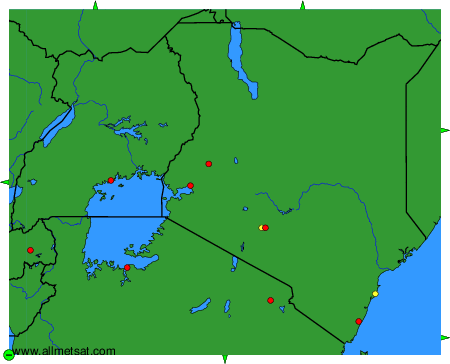
Weather observations and forecasts of more than 4000 airports (METAR and TAF reports).
The available stations are represented by yellow and red dots on the map.
Hover mouse over dot to see the name of the station.
Then click to see weather observations and forecasts.
To change the map : click on the green buttons with a black cross to zoom in, on the green button with a dash to zoom out, or on the green arrows for adjacent maps.