METAR-TAF
Airports :
Biloxi
Alexandria
Alexandria
Amelia
Baton Rouge
Bay St. Louis
Beaumont
Beaumont / Port Arthur
Biloxi
Boothville-Venice
Bossier City
Camden
Cleveland
Columbus
Columbus / West Point / Starkville
Demopolis
DeRidder
El Dorado
Evergreen
Fairhope
Fort Polk
Galveston
Gilmer
Greenville
Greenwood
Gulfport
Gulf Shores
Hammond
Hattiesburg
Hattiesburg / Laurel
Houma
Jackson-Evers
Jackson-Hawkins
Jasper
Jasper
Lafayette
Lake Charles
Lake Charles
Laurel
Longview
Lufkin
Madison
Marshall
McComb
Meridian
Meridian
Milton
Milton
Mobile-downtown
Mobile-regional
Monroe
Monticello
Mount Pleasant
Nacogdoches
Natchez
Natchitoches
New Iberia
New Orleans
New Orleans-Lakefront
New Orleans-Naval
Oakdale
Opelousas
Orange
Pascagoula
Patterson
Pensacola
Pensacola NAS
Port Fourchon
Raymond
Ruston
Salt Point
Shreveport-Downtown
Shreveport-Regional
Slidell
Starkville
Tallulah / Vicksburg
Texarkana
Tuscaloosa
Louisiana
Alabama
Arkansas
Florida
Mexico, East
Mississippi
North America
Oklahoma
Texas, East
Texas, South
Keesler Air Force Base Biloxi, Mississippi, United States
latitude: 30-25N, longitude: 088-55W, elevation: 33 ft
Current weather observation The report was made 36 minutes ago, at 16:16 UTC
Wind 8 mph from the South/Southeast
Temperature 70 °F
Humidity 83 %
Pressure 29.88 in. Hg
Visibility: 10 miles
Overcast at a height of 2100 ft
METAR: KBIX 181616Z AUTO 15007KT 10SM OVC021 21/18 A2988 RMK AO2 RAE1555RAB06E16 CIG 019 RWY22 SLP121
Time: 10:52 (16:52 UTC) Forecast The report was made 5 hours and 52 minutes ago, at 11:00 UTC
Forecast valid from 18 at 11 UTC to 19 at 17 UTC
Wind 12 mph from the Southeast
Visibility: 29527 ft
Broken clouds at a height of 2500 ft Overcast at a height of 6000 ft
light rain
Temporary from 18 at 12 UTC to 18 at 15 UTC
Visibility: 15748 ft
Broken clouds at a height of 1500 ft
light rain showers
Becoming from 18 at 15 UTC to 18 at 16 UTC
Wind 10 mph from the South/Southeast
Visibility: 15748 ft
Broken clouds at a height of 1000 ft Overcast at a height of 3500 ft
mist
Temporary from 18 at 16 UTC to 18 at 19 UTC
Visibility: 5249 ft
Broken clouds at a height of 700 ft Overcast at a height of 2000 ft
light rain showers, mist
Becoming from 18 at 21 UTC to 18 at 22 UTC
Wind 12 mph from the Southwest
Visibility: 26246 ft
Broken clouds at a height of 1000 ft Overcast at a height of 4000 ft
light rain showers, mist
Temporary from 19 at 03 UTC to 19 at 06 UTC
Visibility: 7874 ft
rain showers
Becoming from 19 at 07 UTC to 19 at 08 UTC
Wind 14 mph from the North/Northwest with gusts up to 23 mph
Visibility 6.2 miles or more
Few clouds at a height of 1000 ft
TAF: KBIX 181100Z 1811/1917 14010KT 9000 -RA BKN025 OVC060 QNH2985INS TEMPO 1812/1815 4800 -SHRA BKN015 BECMG 1815/1816 16009KT 4800 BR BKN010 OVC035 QNH2982INS TEMPO 1816/1819 1600 -SHRA BR BKN007 OVC020 BECMG 1821/1822 22010KT 8000 -SHRA BR BKN010 OVC040 QNH2977INS TEMPO 1903/1906 2400 SHRA BECMG 1907/1908 33012G20KT 9999 NSW FEW010 QNH2981INS TX20/1820Z TN10/1911Z
Weather observations and forecasts of more than 4000 airports (METAR and TAF reports).
The available stations are represented by yellow and red dots on the map.
Hover mouse over dot to see the name of the station.
Then click to see weather observations and forecasts.
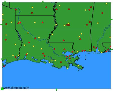
To change the map : click on the green buttons with a black cross to zoom in, on the green button with a dash to zoom out, or on the green arrows for adjacent maps.