METAR-TAF
Airports :
Sir Seewoosagur Ramgoolam International Airport
Mauritius, Mauritius
latitude: 20-26S, longitude: 057-40E, elevation: 180 ft
Current weather observation
The report was made 8 minutes ago, at 08:00 UTC
Wind 16 mph from the South/Southeast
Temperature 77°F
Humidity 61%
Pressure 30.18 in. Hg
Visibility 6.2 miles or more
Scattered clouds at a height of 1600 ft
Scattered clouds at a height of 5000 ft
Scattered clouds at a height of 5000 ft
showers in vicinity
METAR: FIMP 060800Z 16014KT 9999 VCSH SCT016 SCT050 25/17 Q1022
Time: 12:08 (08:08 UTC)
Forecast
The report was made 3 hours and 3 minutes ago, at 05:05 UTC
Forecast valid from 06 at 06 UTC to 07 at 12 UTC
Wind 14 mph from the South
Visibility 6.2 miles or more
Scattered clouds at a height of 1700 ft
Temporary
from 06 at 08 UTC to 06 at 12 UTC
from 06 at 08 UTC to 06 at 12 UTC
Visibility: 22966 ft
Few clouds at a height of 1000 ft
Broken clouds at a height of 1600 ft
Broken clouds at a height of 1600 ft
light rain
TAF: FIMP 060505Z 0606/0712 18012KT 9999 SCT017 TEMPO 0608/0612 7000 -RA FEW010 BKN016
Weather observations and forecasts of more than 4000 airports (METAR and TAF reports).
The available stations are represented by yellow and red dots on the map.
Hover mouse over dot to see the name of the station.
Then click to see weather observations and forecasts.
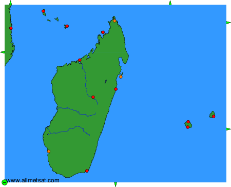
To change the map : click on the green buttons with a black cross to zoom in, on the green button with a dash to zoom out, or on the green arrows for adjacent maps.