METAR-TAF
Airports :
Conakry International Airport
Conakry, Guinea
latitude: 09-34N, longitude: 013-37W, elevation: 26 m
Current weather observation
The report was made 59 minutes ago, at 19:00 UTC
Wind 4 kt from the West/Northwest
Temperature 24°C
Humidity 100%
Pressure 1014 hPa
Visibility: 5000 m
Broken clouds at a height of 1200 ft
Few clouds at a height of 2000 ft, Cumulonimbus.
Overcast at a height of 9000 ft
Few clouds at a height of 2000 ft, Cumulonimbus.
Overcast at a height of 9000 ft
thunderstorm, light rain
METAR: GUCY 171900Z 29004KT 5000 -TSRA BKN012 FEW020CB OVC090 24/24 Q1014 CB/N-NE TEMPO 3000 -TSRA
Time: 19:59 (19:59 UTC)
Forecast
The report was made 2 hours and 59 minutes ago, at 17:00 UTC
Forecast valid from 17 at 18 UTC to 18 at 24 UTC
Wind 8 kt from the West/Southwest
Visibility: 7000 m
Broken clouds at a height of 1300 ft
Broken clouds at a height of 10000 ft
Broken clouds at a height of 10000 ft
Temporary
from 17 at 18 UTC to 17 at 24 UTC
from 17 at 18 UTC to 17 at 24 UTC
Wind 6 kt from the Southwest
Visibility: 3000 m
Broken clouds at a height of 1200 ft
Few clouds at a height of 2000 ft, Cumulonimbus.
Overcast at a height of 10000 ft
Few clouds at a height of 2000 ft, Cumulonimbus.
Overcast at a height of 10000 ft
thunderstorm, rain
TAF: GUCY 171700Z 1718/1824 25008KT 7000 BKN013 BKN100 TEMPO 1718/1724 22006KT 3000 TSRA BKN012 FEW020CB OVC100
Weather observations and forecasts of more than 4000 airports (METAR and TAF reports).
The available stations are represented by yellow and red dots on the map.
Hover mouse over dot to see the name of the station.
Then click to see weather observations and forecasts.
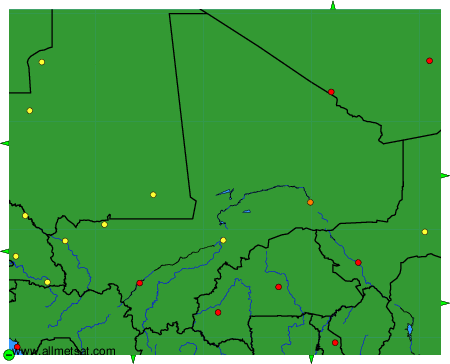
To change the map : click on the green buttons with a black cross to zoom in, on the green button with a dash to zoom out, or on the green arrows for adjacent maps.