METAR-TAF
Airports :
Moncton
Amqui
Argentia
Baie-Comeau
Bar Harbor
Bathurst
Beaver Island
Blanc-Sablon
Brier Island
Cap-Chat
Cap D Espoir
Cape Race
Cap Madeleine
Caribou
Caribou
Cartwright
Charlo
Charlottetown
Chéticamp
Churchill Falls
Debert
Deer Lake
East Point
Englee
Ferolle Point
Fredericton
Frenchville
Gagetown
Gander
Gaspé
Goose Bay
Grand Étang
Greenwood
Halifax
Hart Island
Havre-Saint-Pierre
Heath Point
Hopedale
Houlton
Ile Aux Perroquets
Kejimkujik National Park
Kentville
Longue-Pointe-de-Mingan
Magdalen Islands
Makkovik
Malay Falls
Mary's Harbour
McNabs Island
Moncton
Mont-Joli
Natashquan
New Carlisle
North Cape
Pointe-des-Monts
Pointe-Noire
Point Lepreau
Port Hawkesbury
Port-Menier
Presque Isle
Rocky Harbour
Sable Island
Sagona Island
Saint John
Saint-Léonard
Saint-Pierre
Schefferville
Sept-Îles
Shearwater
St. Anthony
Stephenville
St. John's
St. Paul Island
St. Stephen
Summerside
Sydney
Tukialik Bay
Twillingate
Wabush
Western Head
Yarmouth
Maritimes
Bermuda
Guyana, Suriname, French Guiana
New England
North America
North Atlantic
Quebec
Quebec, South
Greater Moncton Roméo LeBlanc International Airport Moncton, New Brunswick, Canada
latitude: 46-07N, longitude: 064-41W, elevation: 71 m
Current weather observation The report was made 24 minutes ago, at 04:00 UTC
Wind 5 kt from the South
Temperature 17 °C
Humidity 88 %
Pressure 1010 hPa
Visibility: 24.1 km
Few clouds at a height of 24000 ft
METAR: CYQM 090400Z 19005KT 15SM FEW240 17/15 A2983 RMK CI2 SLP103 DENSITY ALT 600FT
Time: 01:24 (04:24 UTC) Forecast The report was made 4 hours and 44 minutes ago, at 23:40 UTC
Forecast valid from 09 at 00 UTC to 09 at 24 UTC
Wind 6 kt from the South
Visibility: 10 km
Few clouds at a height of 10000 ft Scattered clouds at a height of 25000 ft
From 09 at 0600 UTC
Wind 5 kt from the South
Visibility: 10 km
Few clouds at a height of 300 ft
Becoming
Wind 8 kt from the Southwest
From 09 at 1600 UTC
Wind 10 kt from the West with gusts up to 20 kt
Visibility: 10 km
Broken clouds at a height of 5000 ft
Temporary
Visibility: 10 km
light rain showers
Becoming
Wind 7 kt from the South/Southeast
TAF: CYQM 082340Z 0900/0924 17006KT P6SM FEW100 SCT250 FM090600 19005KT P6SM FEW003 BECMG 0910/0912 22008KT FM091600 28010G20KT P6SM BKN050 TEMPO 0918/0922 P6SM -SHRA BECMG 0922/0924 15007KT RMK NXT FCST BY 090600Z
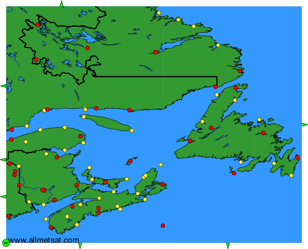
Weather observations and forecasts of more than 4000 airports (METAR and TAF reports).
The available stations are represented by yellow and red dots on the map.
Hover mouse over dot to see the name of the station.
Then click to see weather observations and forecasts.
To change the map : click on the green buttons with a black cross to zoom in, on the green button with a dash to zoom out, or on the green arrows for adjacent maps.