METAR: CZBF 071400Z AUTO 22005KT 190V310 9SM CLR 27/14 A3013 RMK SLP205 DENSITY ALT 1400FT
Time: 11:16 (14:16 UTC)
Forecast
The report was made 36 minutes ago, at 13:40 UTC
Forecast valid from 07 at 14 UTC to 08 at 02 UTC
Wind 5 kt from the West/Southwest
Visibility: 10 km
Clear sky
From 07 at 1800 UTC
Wind 8 kt from the North
Visibility: 10 km
Few clouds at a height of 5000 ft
Becoming from 07 at 22 UTC to 07 at 24 UTC
Wind 3 kt from variable directions
TAF: CZBF 071340Z 0714/0802 25005KT P6SM SKC FM071800 01008KT P6SM FEW050 BECMG 0722/0724 VRB03KT RMK FCST BASED ON AUTO OBS. NXT FCST BY 072000Z
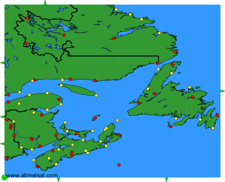
Weather observations and forecasts of more than 4000 airports (METAR and TAF reports).
The available stations are represented by yellow and red dots on the map.
Hover mouse over dot to see the name of the station.
Then click to see weather observations and forecasts.
To change the map : click on the green buttons with a black cross to zoom in, on the green button with a dash to zoom out, or on the green arrows for adjacent maps.