METAR-TAF
Airports :
Hassan I Airport
El Aaiún, Morocco
latitude: 27-10N, longitude: 013-12-59W, elevation: 6 m
Current weather observation
The report was made 41 minutes ago, at 12:00 UTC
Wind 17 kt from the Northeast
Temperature 26°C
Humidity 51%
Pressure 1015 hPa
Visibility: 8000 m
METAR: GMML 101200Z 04017KT 8000 NSC 26/15 Q1015 NOSIG
Time: 13:41 (12:41 UTC)
Forecast
The report was made 1 hour and 41 minutes ago, at 11:00 UTC
Forecast valid from 10 at 12 UTC to 11 at 18 UTC
Wind 18 kt from the Northeast
Visibility: 8000 m
Probability 30% :
Temporary
from 10 at 14 UTC to 10 at 19 UTC
from 10 at 14 UTC to 10 at 19 UTC
Wind 20 kt from the Northeast with gusts up to 30 kt
Visibility: 3000 m
sand
Becoming
from 10 at 18 UTC to 10 at 20 UTC
from 10 at 18 UTC to 10 at 20 UTC
Broken clouds at a height of 1300 ft
Becoming
from 11 at 09 UTC to 11 at 11 UTC
from 11 at 09 UTC to 11 at 11 UTC
Scattered clouds at a height of 1600 ft
TAF: GMML 101100Z 1012/1118 04018KT 8000 NSC PROB30 TEMPO 1014/1019 04020G30KT 3000 SA BECMG 1018/1020 BKN013 BECMG 1109/1111 SCT016
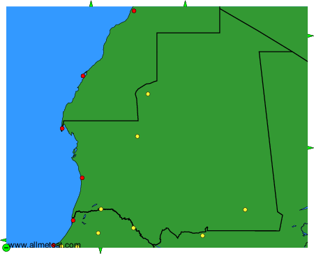
Weather observations and forecasts of more than 4000 airports (METAR and TAF reports).
The available stations are represented by yellow and red dots on the map.
Hover mouse over dot to see the name of the station.
Then click to see weather observations and forecasts.
To change the map : click on the green buttons with a black cross to zoom in, on the green button with a dash to zoom out, or on the green arrows for adjacent maps.