METAR-TAF
Airports :
La Paz
Acapulco
Aguascalientes
Belize City
Cabo San Lucas
Campeche
Cancún
Chetumal
Chichen Itza
Chihuahua
Ciudad Del Carmen
Ciudad Juárez
Ciudad Obregón
Ciudad Victoria
Colima
Cozumel
Cuernavaca
Culiacán
Dallas / Fort Worth
Durango
El Salvador
Guadalajara
Guatemala City
Guaymas
Hermosillo
Houston
Huatulco
La Paz
León
Loreto
Los Mochis
Manzanillo
Matamoros
Mazatlán
Mérida
Mexicali
Mexico City
Minatitlán
Monclova
Monterrey
Monterrey Del Norte
Morelia
New Orleans
Nuevo Laredo
Oaxaca
Palenque
Piedras Negras
Poza Rica
Puebla
Puerto Escondido
Puerto Peñasco
Puerto Vallarta
Querétaro
Reynosa
Saltillo
San José Del Cabo
San Luis Potosí
Tampico
Tapachula
Tegucigalpa
Tepic
Tijuana
Toluca
Torreón
Tuxtla Gutiérrez
Uruapan
Veracruz
Villahermosa
Zacatecas
Zihuatanejo
Mexico
Alabama
Arizona
Arkansas
Belize
California, South
Costa Rica
Cuba
El Salvador
Florida
Galápagos
Georgia
Guatemala
Honduras
Jamaica
Louisiana
Mexico, East
Mexico, Northeast
Mexico, Northwest
Mexico, Southwest
Mississippi
New Mexico
Nicaragua
North America
Oklahoma
Panama
South Pacific
Texas, East
Texas, South
Texas, West
La Paz International Airport La Paz, Mexico
latitude: 24-04N, longitude: 110-22W, elevation: 21 m
Current weather observation The report was made 6 hours and 16 minutes ago, at 20:46 UTC
Wind 7 kt from the North
Temperature 33 °C
Humidity 63 %
Pressure 1011 hPa
Visibility: 16.1 km
Few clouds at a height of 3000 ft, Towering cumulus. Scattered clouds at a height of 20000 ft
METAR: MMLP 162046Z 36007KT 10SM FEW030TCU SCT200 33/25 A2986 RMK SLP108 57022 918 8/208
Time: 21:02 (03:02 UTC) Forecast The report was made 9 hours and 23 minutes ago, at 17:39 UTC
Forecast valid from 16 at 18 UTC to 17 at 18 UTC
Wind 7 kt from the North/Northeast
Visibility: 10 km
Scattered clouds at a height of 2000 ft Scattered clouds at a height of 20000 ft
From 16 at 2200 UTC
Wind 5 kt from the West/Southwest
Visibility: 10 km
Broken clouds at a height of 2000 ft
Temporary from 16 at 23 UTC to 17 at 03 UTC
Visibility: 4.8 km
Broken clouds at a height of 2000 ft, Cumulonimbus.
thunderstorm, rain
From 17 at 0300 UTC
Wind 5 kt from the West/Southwest
Visibility: 8.0 km
Broken clouds at a height of 2000 ft
light rain
From 17 at 1500 UTC
Wind 5 kt from the South/Southwest
Visibility: 10 km
Scattered clouds at a height of 2000 ft
TAF: MMLP 161739Z 1618/1718 02007KT P6SM SCT020 SCT200 FM162200 25005KT P6SM BKN020 TEMPO 1623/1703 3SM TSRA BKN020CB FM170300 25005KT 5SM -RA BKN020 FM171500 20005KT P6SM SCT020
Weather observations and forecasts of more than 4000 airports (METAR and TAF reports).
The available stations are represented by yellow and red dots on the map.
Hover mouse over dot to see the name of the station.
Then click to see weather observations and forecasts.
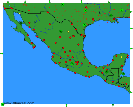
To change the map : click on the green buttons with a black cross to zoom in, on the green button with a dash to zoom out, or on the green arrows for adjacent maps.