METAR-TAF
Airports :
Houghton County Memorial Airport
Hancock, Michigan, United States
latitude: 47-10-06N, longitude: 088-29-20W, elevation: 1096 ft
Current weather observation
The report was made 18 hours and 59 minutes ago, at 12:53 UTC
Wind 10 mph from the West
Temperature 73°F
Humidity 83%
Pressure 29.91 in. Hg
Visibility: 10 miles
Clear sky
METAR: KCMX 311253Z AUTO 28009KT 10SM CLR 23/20 A2991 RMK AO2 SLP122 T02330200
Time: 03:52 (07:52 UTC)
Forecast
The report was made 2 hours and 32 minutes ago, at 05:20 UTC
Forecast valid from 01 at 06 UTC to 02 at 06 UTC
Wind 3 mph from variable directions
Visibility: 6 miles
Overcast at a height of 15000 ft
From 01 at 1000 UTC
Wind 3 mph from variable directions
Visibility: 3 miles
Overcast at a height of 2300 ft
mist
From 01 at 1300 UTC
Wind 7 mph from the North
Visibility: 6 miles
Broken clouds at a height of 3500 ft
From 01 at 1500 UTC
Wind 8 mph from the North/Northeast
Visibility: 6 miles
Scattered clouds at a height of 6000 ft
TAF: KCMX 010520Z 0106/0206 VRB03KT P6SM OVC150 FM011000 VRB03KT 3SM BR OVC023 FM011300 01006KT P6SM BKN035 FM011500 03007KT P6SM SCT060
Weather observations and forecasts of more than 4000 airports (METAR and TAF reports).
The available stations are represented by yellow and red dots on the map.
Hover mouse over dot to see the name of the station.
Then click to see weather observations and forecasts.
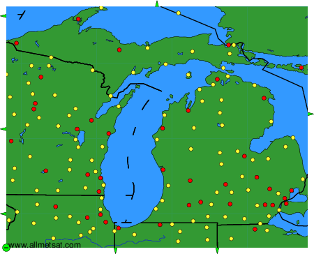
To change the map : click on the green buttons with a black cross to zoom in, on the green button with a dash to zoom out, or on the green arrows for adjacent maps.