METAR-TAF
Airports :
Waukesha County Airport
Waukesha, Wisconsin, United States
latitude: 43-02-28N, longitude: 088-14-13W, elevation: 912 ft
Current weather observation
The report was made 11 minutes ago, at 19:45 UTC
Wind 9 mph from the North
Temperature 73°F
Humidity 73%
Pressure 29.91 in. Hg
Visibility: 10 miles
Broken clouds at a height of 2500 ft
Broken clouds at a height of 3100 ft
Overcast at a height of 3800 ft
Broken clouds at a height of 3100 ft
Overcast at a height of 3800 ft
METAR: KUES 021945Z 36008KT 10SM BKN025 BKN031 OVC038 23/18 A2991
Time: 14:56 (19:56 UTC)
Forecast
The report was made 2 hours and 36 minutes ago, at 17:20 UTC
Forecast valid from 02 at 18 UTC to 03 at 18 UTC
Wind 12 mph from the North/Northeast
Visibility: 6 miles
Broken clouds at a height of 2100 ft
From 02 at 1930 UTC
Wind 13 mph from the North/Northeast
Visibility: 6 miles
Scattered clouds at a height of 3500 ft
From 03 at 0300 UTC
Wind 5 mph from variable directions
Visibility: 6 miles
TAF: KUES 021720Z 0218/0318 02010KT P6SM BKN021 FM021930 03011KT P6SM SCT035 FM030300 VRB04KT P6SM SKC
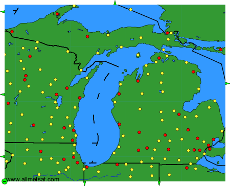
Weather observations and forecasts of more than 4000 airports (METAR and TAF reports).
The available stations are represented by yellow and red dots on the map.
Hover mouse over dot to see the name of the station.
Then click to see weather observations and forecasts.
To change the map : click on the green buttons with a black cross to zoom in, on the green button with a dash to zoom out, or on the green arrows for adjacent maps.