METAR-TAF
Airports :
Bemidji Regional Airport
Bemidji, Minnesota, United States
latitude: 47-30N, longitude: 094-56W, elevation: 1387 ft
Current weather observation
The report was made 29 minutes ago, at 10:15 UTC
Calm wind
Temperature 59°F
Humidity 100%
Pressure 29.99 in. Hg
Visibility: 10 miles
Scattered clouds at a height of 11000 ft
METAR: KBJI 021015Z AUTO 00000KT 10SM SCT110 15/15 A2999 RMK AO2 T01540154
Time: 05:44 (10:44 UTC)
Forecast
The report was made 5 hours and 24 minutes ago, at 05:20 UTC
Forecast valid from 02 at 06 UTC to 03 at 06 UTC
Wind 3 mph from variable directions
Visibility: 6 miles
Few clouds at a height of 25000 ft
From 02 at 0800 UTC
Wind 5 mph from the East/Southeast
Visibility: 6 miles
Few clouds at a height of 25000 ft
From 02 at 1600 UTC
Wind 10 mph from the South
Visibility: 6 miles
Few clouds at a height of 25000 ft
From 02 at 2000 UTC
Wind 14 mph from the South/Southeast with gusts up to 23 mph
Visibility: 6 miles
Few clouds at a height of 25000 ft
TAF: KBJI 020520Z 0206/0306 VRB03KT P6SM FEW250 FM020800 12004KT P6SM FEW250 FM021600 17009KT P6SM FEW250 FM022000 16012G20KT P6SM FEW250
Weather observations and forecasts of more than 4000 airports (METAR and TAF reports).
The available stations are represented by yellow and red dots on the map.
Hover mouse over dot to see the name of the station.
Then click to see weather observations and forecasts.
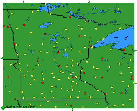
To change the map : click on the green buttons with a black cross to zoom in, on the green button with a dash to zoom out, or on the green arrows for adjacent maps.