METAR-TAF
Airports :
La Crosse
Aitkin
Albert Lea
Alexandria
Algona
Appleton
Ashland
Austin
Baraboo / Wisconsin Dells
Baudette
Bemidji
Benson
Bigfork
Black River Falls
Boscobel
Brainerd
Buffalo
Cambridge
Camp Douglas
Charles City
Cloquet
Cook
Crane Lake
Crookston
Cumberland
Decorah
Detroit Lakes
Dodge Center
Duluth
Duluth
Eau Claire
Ely
Estherville
Eveleth
Fairmont
Fargo
Faribault
Fergus Falls
Flag Island
Forest City
Fosston
Glencoe
Glenwood
Grand Forks
Grand Forks
Grand Marais
Grand Marais
Grand Rapids
Granite Falls
Hallock
Hayward
Hibbing
Hutchinson
International Falls
Ironwood
Jackson
La Crosse
Ladysmith
Litchfield
Little Falls
Lone Rock
Longville
Luverne
Madison
Madison
Mankato
Maple Lake
Marshall
Marshfield
Mason City
McGregor
Medford
Menomonie
Merrill
Minneapolis
Minneapolis / Blaine
Minneapolis / Crystal
Minneapolis / Eden Prairie
Minneapolis / Lakeville
Minocqua / Woodruff
Montevideo
Moorhead
Moose Lake
Mora
Morris
Mosinee
New Richmond
New Ulm
Olivia
Orr
Ortonville
Osceola
Owatonna
Park Rapids
Phillips
Pine River
Pipestone
Prairie du Chien
Preston
Princeton
Red Wing
Redwood Falls
Rice Lake
Rochester
Roseau
Rush City
Saint Paul
Sheldon
Silver Bay
Sioux Falls
Siren
Sisseton
South St. Paul
Sparta
Spencer
Stanton
Staples
St. Cloud
Stevens Point
St. James
Superior
Thief River Falls
Tomahawk
Two Harbors
Upsala
Wadena
Wahpeton
Warroad
Waseca
Waskish
Watertown
Wausau
Wheaton
Willmar
Windom
Winona
Wisconsin Rapids
Worthington
Minnesota
Dakota
Iowa
Manitoba
Michigan
North America
Ontario, North
Wisconsin
La Crosse Regional Airport La Crosse, Wisconsin, United States
latitude: 43-52-46N, longitude: 091-15-24W, elevation: 653 ft
Current weather observation The report was made 31 minutes ago, at 11:53 UTC
Wind 13 mph from the Northeast with gusts up to 21 mph
Temperature 43 °F
Humidity 70 %
Pressure 29.77 in. Hg
Visibility: 10 miles
Clear sky
METAR: KLSE 221153Z 05011G18KT 10SM CLR 06/01 A2977 RMK AO2 SLP077 T00610011 10167 20061 51013
Time: 07:24 (12:24 UTC) Forecast The report was made 1 hour and 4 minutes ago, at 11:20 UTC
Forecast valid from 22 at 12 UTC to 23 at 12 UTC
Wind 12 mph from the North/Northeast with gusts up to 20 mph
Visibility: 6 miles
Broken clouds at a height of 10000 ft
From 22 at 1600 UTC
Wind 10 mph from the North
Visibility: 6 miles
Broken clouds at a height of 3000 ft
From 22 at 1900 UTC
Wind 10 mph from the North
Visibility: 6 miles
Broken clouds at a height of 5000 ft
From 22 at 2300 UTC
Wind 8 mph from the North
Visibility: 6 miles
Broken clouds at a height of 25000 ft
From 23 at 0200 UTC
Wind 6 mph from the North
Visibility: 6 miles
Few clouds at a height of 25000 ft
From 23 at 0600 UTC
Wind 0 mph from the North
Visibility: 6 miles
TAF: KLSE 221120Z 2212/2312 02010G17KT P6SM BKN100 FM221600 36009KT P6SM BKN030 FM221900 36009KT P6SM BKN050 FM222300 35007KT P6SM BKN250 FM230200 36005KT P6SM FEW250 FM230600 00000KT P6SM SKC
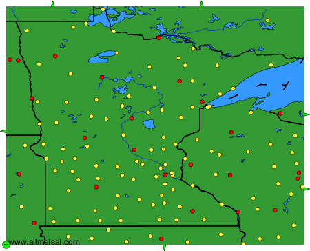
Weather observations and forecasts of more than 4000 airports (METAR and TAF reports).
The available stations are represented by yellow and red dots on the map.
Hover mouse over dot to see the name of the station.
Then click to see weather observations and forecasts.
To change the map : click on the green buttons with a black cross to zoom in, on the green button with a dash to zoom out, or on the green arrows for adjacent maps.