METAR-TAF
Airports :
Lacon
Alton / St. Louis
Atlantic
Batesville
Belleville
Bentonville
Bloomington / Normal
Blytheville
Blytheville
Boonville
Branson
Burlington
Cahokia / St. Louis
Cairo
Camdenton
Cape Girardeau
Carbondale / Murphysboro
Carmi
Centralia
Champaign / Urbana
Chanute
Chariton
Chillicothe
Claremore
Clarinda
Clinton
Coffeyville
Columbia
Council Bluffs
Creston
Decatur
Dyersburg
Effingham
Fairfield
Fairfield
Falls City
Farmington
Fayetteville
Fayetteville
Flippin
Flora
Fort Leonard Wood
Fort Madison
Fort Smith
Galesburg
Grove
Hannibal
Harrisburg
Harrison
Independence
Jackson
Jacksonville
Jefferson City
Jonesboro
Joplin
Kaiser Lake Ozark
Kansas City
Kansas City
Keokuk
Kirksville
Knob Noster
Knoxville
Lacon
Lamoni
Lawrence
Lee's Summit
Lincoln
Litchfield
Macomb
Malden
Marion
Marshall
Mattoon / Charleston
Memphis
Metropolis
Millington
Mountain Home
Mount Pleasant
Mount Vernon
Murray
Muscatine
Muskogee
Nebraska City
Okmulgee
Olathe
Olathe
Olney-Noble
Omaha
Omaha
Ottawa
Ottumwa
Paducah
Paris
Parsons
Parsons
Pella
Peoria
Peru / LaSalle
Pittsburg
Pittsfield
Pontiac
Poplar Bluff
Poteau
Quincy
Rantoul
Red Oak
Rogers
Rolla
Russellville
Saint Charles
Saint Joseph
Salem
Sallisaw
Searcy
Sedalia
Shenandoah
Sikeston
Siloam Springs
Sparta
Springdale
Springfield
Springfield
Stigler
St. Louis
St. Louis
Tahlequah
Taylorville
Topeka
Topeka
Tulsa
Tulsa
Walnut Ridge
Warrensburg
Washington
West Memphis
West Plains
Missouri
Arkansas
Illinois
Indiana
Iowa
Kansas
Kentucky
Nebraska
North America
Oklahoma
Tennessee
Marshall County Airport Lacon, Illinois, United States
latitude: 41-01-09N, longitude: 089-23-11W, elevation: 567 ft
Current weather observation The report was made 20 minutes ago, at 23:55 UTC
Calm wind
Temperature 68 °F
Humidity 68 %
Pressure 30.27 in. Hg
Visibility: 10 miles
Overcast at a height of 4600 ft
METAR: KC75 242355Z AUTO 00000KT 10SM OVC046 20/14 A3027 RMK AO2 T01950139 10220 20195
Time: 19:15 (00:15 UTC) TAF: missing
Weather observations and forecasts of more than 4000 airports (METAR and TAF reports).
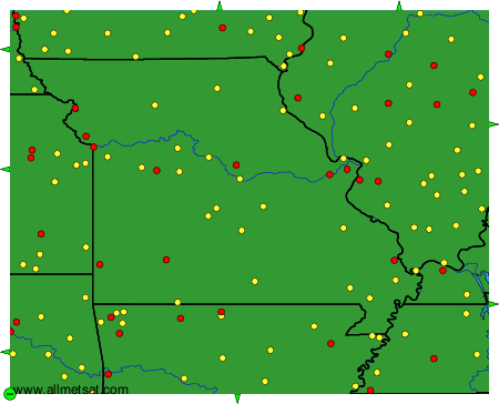
The available stations are represented by yellow and red dots on the map.
Hover mouse over dot to see the name of the station.
Then click to see weather observations and forecasts.
To change the map : click on the green buttons with a black cross to zoom in, on the green button with a dash to zoom out, or on the green arrows for adjacent maps.