Main page
METAR-TAF:

METAR-TAF

Airports :

Rosecrans Memorial Airport

Saint Joseph, Missouri, United States

latitude: 39-46-05N, longitude: 094-54-33W, elevation: 823 ft

Current weather observation

The report was made 53 minutes ago, at 21:53 UTC
Wind 15 mph from the South with gusts up to 24 mph
Temperature 57°F
Humidity 44%
Pressure 30.04 in. Hg
Visibility: 10 miles
Clear sky

METAR: KSTJ 022153Z 19013G21KT 10SM CLR 14/02 A3004 RMK AO2 SLP175 T01440017

Time: 16:46 (22:46 UTC)

Forecast

The report was made 5 hours and 21 minutes ago, at 17:25 UTC
Forecast valid from 02 at 18 UTC to 03 at 18 UTC
Wind 14 mph from the South
Visibility: 6 miles
Clear sky
From 03 at 0400 UTC
Wind 5 mph from variable directions
Visibility: 6 miles
Clear sky
From 03 at 1500 UTC
Wind 9 mph from the North/Northeast
Visibility: 6 miles

TAF: KSTJ 021725Z 0218/0318 19012KT P6SM SKC FM030400 VRB04KT P6SM SKC FM031500 02008KT P6SM SKC

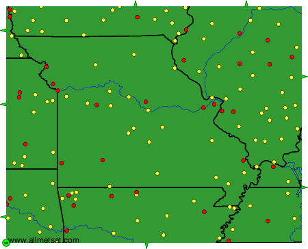
Weather observations and forecasts of more than 4000 airports (METAR and TAF reports).

The available stations are represented by yellow and red dots on the map.

Hover mouse over dot to see the name of the station.

Then click to see weather observations and forecasts.

To change the map : click on the green buttons with a black cross to zoom in, on the green button with a dash to zoom out, or on the green arrows for adjacent maps.


METAR-TAF: