METAR-TAF
Airports :
Hohhot Baita International Airport
Hohhot, China
latitude: 40-49N, longitude: 111-41E, elevation: 1065 m
Current weather observation
The report was made 43 minutes ago, at 19:00 UTC
Wind 4 kt from the East/Southeast
Temperature 18°C
Humidity 94%
Pressure 1014 hPa
Visibility 10 km or more
Scattered clouds at a height of 4000 ft
light rain
METAR: ZBHH 021900Z 11002MPS 9999 -RA SCT040 18/17 Q1014 NOSIG
Time: 03:43 (19:43 UTC)
Forecast
The report was made 4 hours and 33 minutes ago, at 15:10 UTC
Forecast valid from 02 at 18 UTC to 03 at 18 UTC
Wind 8 kt from the East
Visibility: 6000 m
Scattered clouds at a height of 3000 ft
light rain
Temporary
from 02 at 18 UTC to 02 at 21 UTC
from 02 at 18 UTC to 02 at 21 UTC
Visibility: 2800 m
rain showers
Becoming
from 03 at 05 UTC to 03 at 06 UTC
from 03 at 05 UTC to 03 at 06 UTC
TAF: ZBHH 021510Z 0218/0318 10004MPS 6000 -RA SCT030 TX22/0308Z TN16/0222Z TEMPO 0218/0221 2800 SHRA BECMG 0305/0306 NSW
Weather observations and forecasts of more than 4000 airports (METAR and TAF reports).
The available stations are represented by yellow and red dots on the map.
Hover mouse over dot to see the name of the station.
Then click to see weather observations and forecasts.
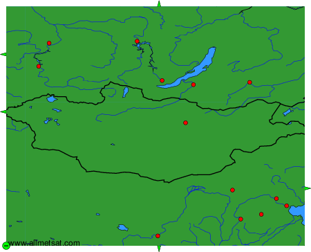
To change the map : click on the green buttons with a black cross to zoom in, on the green button with a dash to zoom out, or on the green arrows for adjacent maps.