METAR-TAF
Airports :
Air Force Base Hoedspruit
Hoedspruit, South Africa
latitude: 24-21-17S, longitude: 31-03-01E, elevation: 531 m
Current weather observation
The report was made 56 minutes ago, at 07:00 UTC
Wind 3 kt from the South/Southeast
Temperature 18°C
Humidity 73%
Pressure 1026 hPa
METAR: FAHS 130700Z AUTO 16003KT //// // ////// 18/13 Q1026
Time: 09:56 (07:56 UTC)
Forecast
The report was made 1 hour and 56 minutes ago, at 06:00 UTC
Forecast valid from 13 at 07 UTC to 13 at 18 UTC
Wind 3 kt from variable directions
Visibility 10 km or more
Scattered clouds at a height of 4000 ft
Becoming
from 13 at 10 UTC to 13 at 12 UTC
from 13 at 10 UTC to 13 at 12 UTC
Wind 8 kt from the North
Probability 30% :
Temporary
from 13 at 14 UTC to 13 at 18 UTC
from 13 at 14 UTC to 13 at 18 UTC
Few clouds at a height of 4000 ft, Cumulonimbus.
thunderstorm, light rain
TAF: FAHS 130600Z 1307/1318 VRB03KT 9999 SCT040 TX22/1312Z TN16/1318Z BECMG 1310/1312 36008KT PROB30 TEMPO 1314/1318 -TSRA FEW040CB
Weather observations and forecasts of more than 4000 airports (METAR and TAF reports).
The available stations are represented by yellow and red dots on the map.
Hover mouse over dot to see the name of the station.
Then click to see weather observations and forecasts.
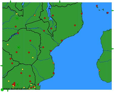
To change the map : click on the green buttons with a black cross to zoom in, on the green button with a dash to zoom out, or on the green arrows for adjacent maps.