METAR-TAF
Airports :
Mfuwe Airport
Mfuwe, Zambia
latitude: 13-15-32S, longitude: 031-56-12E, elevation: 573 m
METAR: missing
Time: 13:31 (11:31 UTC)
Forecast
The report was made 1 hour and 31 minutes ago, at 10:00 UTC
Forecast valid from 28 at 12 UTC to 29 at 18 UTC
Wind 12 kt from the East/Southeast
Visibility 10 km or more
Broken clouds at a height of 4000 ft
From 28 at 1400 UTC
Visibility 10 km or more
no clouds below 1500 m and no cumulonimbus
Becoming
from 29 at 06 UTC to 29 at 08 UTC
from 29 at 06 UTC to 29 at 08 UTC
Wind 10 kt from the Southeast
Visibility 10 km or more
Scattered clouds at a height of 1000 ft
Becoming
from 29 at 08 UTC to 29 at 10 UTC
from 29 at 08 UTC to 29 at 10 UTC
Broken clouds at a height of 4000 ft
TAF: FLMF 281000Z 2812/2918 12012KT 9999 BKN040 FM281400 CAVOK BECMG 2906/2908 13010KT 9999 SCT010 BECMG 2908/2910 BKN040
Weather observations and forecasts of more than 4000 airports (METAR and TAF reports).
The available stations are represented by yellow and red dots on the map.
Hover mouse over dot to see the name of the station.
Then click to see weather observations and forecasts.
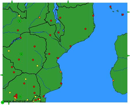
To change the map : click on the green buttons with a black cross to zoom in, on the green button with a dash to zoom out, or on the green arrows for adjacent maps.