METAR-TAF
Airports :
Prince Said Ibrahim International Airport
Moroni, Comoros
latitude: 11-32S, longitude: 043-16E, elevation: 95 ft
Current weather observation
The report was made 38 minutes ago, at 12:00 UTC
Wind 22 mph from the South/Southwest
Temperature 82°F
Humidity 58%
Pressure 29.97 in. Hg
Visibility 6.2 miles or more
Few clouds at a height of 2000 ft, Towering cumulus.
METAR: FMCH 171200Z 21019KT 9999 FEW020TCU 28/19 Q1015 NOSIG
Time: 15:38 (12:38 UTC)
Forecast
The report was made 1 hour and 38 minutes ago, at 11:00 UTC
Forecast valid from 17 at 12 UTC to 18 at 18 UTC
Wind 23 mph from the South/Southwest
Visibility 6.2 miles or more
Few clouds at a height of 2000 ft, Towering cumulus.
Becoming
from 17 at 16 UTC to 17 at 18 UTC
from 17 at 16 UTC to 17 at 18 UTC
Wind 6 mph from the East/Southeast
Becoming
from 18 at 05 UTC to 18 at 07 UTC
from 18 at 05 UTC to 18 at 07 UTC
Wind 17 mph from the South/Southwest
TAF: FMCH 171100Z 1712/1818 21020KT 9999 FEW020TCU BECMG 1716/1718 11005KT BECMG 1805/1807 21015KT
Weather observations and forecasts of more than 4000 airports (METAR and TAF reports).
The available stations are represented by yellow and red dots on the map.
Hover mouse over dot to see the name of the station.
Then click to see weather observations and forecasts.
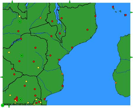
To change the map : click on the green buttons with a black cross to zoom in, on the green button with a dash to zoom out, or on the green arrows for adjacent maps.