METAR-TAF
Airports :
Beira Airport
Beira, Mozambique
latitude: 19-48S, longitude: 034-54E, elevation: 8 m
Current weather observation
The report was made 1 hour and 2 minutes ago, at 06:00 UTC
Wind 5 kt from the Northwest
Temperature 18°C
Humidity 94%
Pressure 1021 hPa
Visibility: 4000 m
mist
METAR: FQBR 150600Z 32005KT 4000 BR NSC 18/17 Q1021
Time: 09:02 (07:02 UTC)
Forecast
The report was made 3 hours and 2 minutes ago, at 04:00 UTC
Forecast valid from 15 at 06 UTC to 16 at 12 UTC
Wind 7 kt from the West/Southwest
Visibility 10 km or more
Few clouds at a height of 2000 ft
Becoming
from 15 at 13 UTC to 15 at 15 UTC
from 15 at 13 UTC to 15 at 15 UTC
Wind 10 kt from the East
Becoming
from 16 at 00 UTC to 16 at 02 UTC
from 16 at 00 UTC to 16 at 02 UTC
Wind 2 kt from variable directions
TAF: FQBR 150400Z 1506/1612 25007KT 9999 FEW020 TX30/1513Z TN18/1603Z BECMG 1513/1515 09010KT BECMG 1600/1602 VRB02KT
Weather observations and forecasts of more than 4000 airports (METAR and TAF reports).
The available stations are represented by yellow and red dots on the map.
Hover mouse over dot to see the name of the station.
Then click to see weather observations and forecasts.
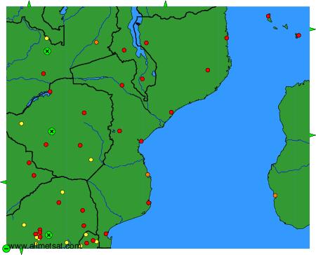
To change the map : click on the green buttons with a black cross to zoom in, on the green button with a dash to zoom out, or on the green arrows for adjacent maps.