METAR-TAF
Airports :
Pemba Airport
Pemba, Mozambique
latitude: 12-59S, longitude: 040-32E, elevation: 101 m
Current weather observation
The report was made 55 minutes ago, at 17:00 UTC
Temperature 29°C
Humidity 74%
Pressure 1013 hPa
Visibility 10 km or more
Few clouds at a height of 2000 ft
METAR: FQPB 211700Z /////KT 9999 FEW020 29/24 Q1013
Time: 19:55 (17:55 UTC)
Forecast
The report was made 1 hour and 55 minutes ago, at 16:00 UTC
Forecast valid from 21 at 18 UTC to 22 at 18 UTC
Wind 8 kt from the Southwest
Visibility 10 km or more
Broken clouds at a height of 2000 ft
Probability 30% :
Temporary
from 21 at 18 UTC to 21 at 24 UTC
from 21 at 18 UTC to 21 at 24 UTC
Visibility: 5000 m
Scattered clouds at a height of 1500 ft
Broken clouds at a height of 1800 ft
Broken clouds at a height of 1800 ft
light rain
Becoming
from 22 at 09 UTC to 22 at 11 UTC
from 22 at 09 UTC to 22 at 11 UTC
Wind 14 kt from the South/Southeast
TAF: FQPB 211600Z 2118/2218 22008KT 9999 BKN020 TX30/2213Z TN24/2203Z PROB30 TEMPO 2118/2124 5000 -RA SCT015 BKN018 BECMG 2209/2211 16014KT
Weather observations and forecasts of more than 4000 airports (METAR and TAF reports).
The available stations are represented by yellow and red dots on the map.
Hover mouse over dot to see the name of the station.
Then click to see weather observations and forecasts.
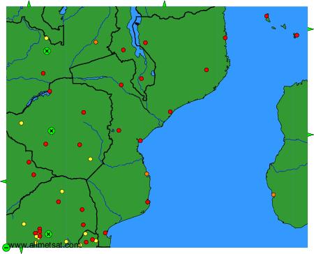
To change the map : click on the green buttons with a black cross to zoom in, on the green button with a dash to zoom out, or on the green arrows for adjacent maps.