METAR-TAF
Airports :
Chingozi Airport
Tete, Mozambique
latitude: 16-06S, longitude: 033-38E, elevation: 160 m
Current weather observation
The report was made 17 minutes ago, at 05:00 UTC
Calm wind
Temperature 16°C
Humidity 77%
Pressure 1023 hPa
Visibility 10 km or more
Scattered clouds at a height of 1800 ft
Scattered clouds at a height of 9000 ft
Scattered clouds at a height of 9000 ft
METAR: FQTT 270500Z 00000KT 9999 SCT018 SCT090 16/12 Q1023
Time: 07:17 (05:17 UTC)
Forecast
The report was made 1 hour and 17 minutes ago, at 04:00 UTC
Forecast valid from 27 at 06 UTC to 28 at 06 UTC
Wind 1 kt from variable directions
Visibility 10 km or more
Scattered clouds at a height of 1800 ft
Becoming
from 27 at 12 UTC to 27 at 14 UTC
from 27 at 12 UTC to 27 at 14 UTC
Wind 8 kt from the South/Southeast
Becoming
from 27 at 18 UTC to 27 at 20 UTC
from 27 at 18 UTC to 27 at 20 UTC
Wind 8 kt from the Northeast
TAF: FQTT 270400Z 2706/2806 VRB01KT 9999 SCT018 TX29/2713Z TN15/2803Z BECMG 2712/2714 15008KT BECMG 2718/2720 04008KT
Weather observations and forecasts of more than 4000 airports (METAR and TAF reports).
The available stations are represented by yellow and red dots on the map.
Hover mouse over dot to see the name of the station.
Then click to see weather observations and forecasts.
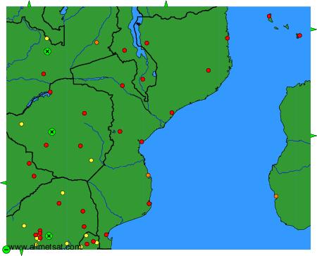
To change the map : click on the green buttons with a black cross to zoom in, on the green button with a dash to zoom out, or on the green arrows for adjacent maps.