METAR-TAF
Airports :
Walvis Bay Airport
Walvis Bay, Namibia
latitude: 22-58-59S, longitude: 014-39E, elevation: 46 m
Current weather observation
The report was made 57 minutes ago, at 21:00 UTC
Wind 1 kt from the North
Temperature 11°C
Humidity 87%
Pressure 1020 hPa
METAR: FYWB 062100Z AUTO 01001KT //// // ////// 11/09 Q1020
Time: 23:57 (21:57 UTC)
Forecast
The report was made 5 hours and 57 minutes ago, at 16:00 UTC
Forecast valid from 06 at 18 UTC to 07 at 18 UTC
Wind 5 kt from the West
Visibility 10 km or more
no clouds below 1500 m and no cumulonimbus
Becoming
from 06 at 19 UTC to 06 at 21 UTC
from 06 at 19 UTC to 06 at 21 UTC
Wind 6 kt from the East/Southeast
Visibility 10 km or more
Scattered clouds at a height of 800 ft
Becoming
from 07 at 01 UTC to 07 at 03 UTC
from 07 at 01 UTC to 07 at 03 UTC
Wind 4 kt from the East
Visibility: 0500 m
Overcast at a height of 300 ft
fog
Becoming
from 07 at 04 UTC to 07 at 06 UTC
from 07 at 04 UTC to 07 at 06 UTC
Visibility 10 km or more
Broken clouds at a height of 1000 ft
TAF: FYWB 061600Z 0618/0718 26005KT CAVOK BECMG 0619/0621 12006KT 9999 SCT008 BECMG 0701/0703 08004KT 0500 FG OVC003 BECMG 0704/0706 9999 NSW BKN010
Weather observations and forecasts of more than 4000 airports (METAR and TAF reports).
The available stations are represented by yellow and red dots on the map.
Hover mouse over dot to see the name of the station.
Then click to see weather observations and forecasts.
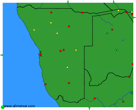
To change the map : click on the green buttons with a black cross to zoom in, on the green button with a dash to zoom out, or on the green arrows for adjacent maps.