METAR-TAF
Airports :
Huron
Ainsworth
Akron
Albion
Alliance
Aurora
Beatrice
Broken Bow
Burlington
Chadron
Chamberlain
Colby
Columbus
Concordia
Custer
Emporia
Fort Morgan
Fort Riley
Fremont
Goodland
Grand Island
Great Bend
Hastings
Hays
Hebron
Hill City
Holdrege
Huron
Imperial
Kearney
Kimball
Le Mars
Lexington
Limon
Lincoln
Luverne
Madison
Manhattan
McCook
Mitchell
Norfolk
North Platte
Ogallala
Omaha
O'Neill
Ord
Philip
Pierre
Pine Ridge
Pipestone
Rapid City
Rapid City / Ellsworth
Russell
Salina
Scottsbluff
Sidney
Sioux City
Sioux Falls
Spearfish
St. Francis
Tekamah
Thedford
Valentine
Wahoo
Winner
Yankton
York
Nebraska
Colorado
Dakota
Iowa
Kansas
Minnesota
North America
Wyoming
Huron Regional Airport Huron, South Dakota, United States
latitude: 44-23-17N, longitude: 098-13-42W, elevation: 1286 ft
Current weather observation The report was made 11 minutes ago, at 20:55 UTC
Wind 13 mph from the Southeast with gusts up to 26 mph
Temperature 43 °F
Humidity 39 %
Pressure 29.73 in. Hg
Visibility: 10 miles
Broken clouds at a height of 11000 ft
METAR: KHON 142055Z AUTO 13011G23KT 10SM BKN110 06/M07 A2973 RMK AO2 PK WND 10026/2019 SLP077 T00561067 56042
Time: 16:06 (21:06 UTC) Forecast The report was made 3 hours and 29 minutes ago, at 17:37 UTC
Forecast valid from 14 at 18 UTC to 15 at 18 UTC
Wind 16 mph from the East with gusts up to 24 mph
Visibility: 6 miles
Few clouds at a height of 1500 ft Broken clouds at a height of 9000 ft
From 14 at 2200 UTC
Wind 20 mph from the Southeast with gusts up to 32 mph
Visibility: 6 miles
Overcast at a height of 9000 ft
Probability 30%
Visibility: 5 miles
Overcast at a height of 4000 ft
light rain, snow
From 15 at 0300 UTC
Wind 23 mph from the East/Northeast with gusts up to 33 mph
Visibility: 3 miles
Overcast at a height of 1000 ft
light snow
From 15 at 0500 UTC
Wind 22 mph from the Northeast with gusts up to 35 mph
Visibility: 0.75 miles
Overcast at a height of 700 ft
light snow, Blowing snow
From 15 at 1000 UTC
Wind 31 mph from the North with gusts up to 44 mph
Visibility: 0.75 miles
Overcast at a height of 1400 ft
light snow, Blowing snow
From 15 at 1500 UTC
Wind 36 mph from the North with gusts up to 52 mph
Visibility: 6 miles
Overcast at a height of 2500 ft
Blowing snow
TAF: KHON 141737Z 1418/1518 10014G21KT P6SM FEW015 BKN090 FM142200 13017G28KT P6SM OVC090 PROB30 1422/1503 5SM -RASN OVC040 FM150300 07020G29KT 3SM -SN OVC010 FM150500 05019G30KT 3/4SM -SN BLSN OVC007 FM151000 01027G38KT 3/4SM -SN BLSN OVC014 FM151500 36031G45KT 6SM BLSN OVC025
Weather observations and forecasts of more than 4000 airports (METAR and TAF reports).
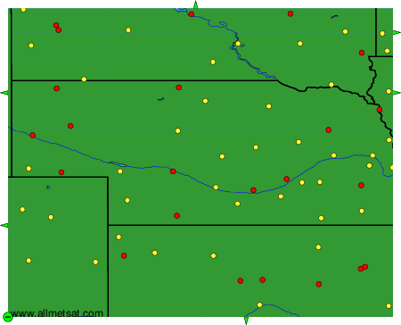
The available stations are represented by yellow and red dots on the map.
Hover mouse over dot to see the name of the station.
Then click to see weather observations and forecasts.
To change the map : click on the green buttons with a black cross to zoom in, on the green button with a dash to zoom out, or on the green arrows for adjacent maps.
