METAR-TAF
Airports :
Spangdahlem
Albert
Amsterdam
Antwerp
Arnhem
Awg-1
Beauvais
Beauvechain
Brussels
Büchel
Bütgenbach
Charleroi
Chièvres
Cologne
Den Helder
Diest
Dortmund
Düsseldorf
Eindhoven
Euro
Florennes
Geilenkirchen
Gilze-Rijen
Goeree Le
Groningen
Hahn
Hoorn-a
J6-a
K13-a
K14-fa-1c
Koksijde
L9-ff-1
Leeuwarden
Lelystad
Liège
Lille
Luxembourg
Maastricht Aachen
Meppen
Mönchengladbach
Münster-Osnabrück
Nörvenich
Ostend
P11-b
Peer
Pontoise
Ramstein
Reims
Rheine
Rotterdam
Saarbrücken
Spangdahlem
Uden
Vlieland
Vlissingen
Weeze
Wittmund
Woensdrecht
Netherlands, Belgium, Luxembourg
Europe
France
Germany
Scandinavia, Southwest
United Kingdom
Spangdahlem Air Base Spangdahlem, Germany
latitude: 49-59N, longitude: 006-42E, elevation: 365 m
Current weather observation The report was made 17 minutes ago, at 20:55 UTC
Calm wind
Temperature 7 °C
Humidity 81 %
Pressure 998 hPa
Visibility 10 km or more
Few clouds at a height of 2800 ft Overcast at a height of 5000 ft
METAR: ETAD 142055Z 00000KT 9999 FEW028 OVC050 07/04 A2948 RMK AO2A RAB1955E01 SLP978 P0000 60000 T00660041 52010 $
Time: 23:12 (21:12 UTC) Forecast The report was made 1 hour and 12 minutes ago, at 20:00 UTC
Forecast valid from 14 at 20 UTC to 16 at 02 UTC
Wind 3 kt from variable directions
Visibility 10 km or more
Overcast at a height of 2500 ft
Temporary
Visibility: 8000 m
light rain
Becoming
Wind 6 kt from the North
Visibility 10 km or more
Overcast at a height of 1500 ft
Becoming
Wind 6 kt from the North
Visibility 10 km or more
Broken clouds at a height of 3000 ft
Becoming
Wind 9 kt from the Northwest
Visibility 10 km or more
Broken clouds at a height of 7000 ft
Becoming
Wind 3 kt from the Northwest
Visibility 10 km or more
Broken clouds at a height of 3000 ft
TAF: ETAD 142000Z 1420/1602 VRB03KT 9999 OVC025 620409 QNH2947INS TEMPO 1420/1421 8000 -RA BECMG 1500/1501 35006KT 9999 OVC015 620409 QNH2949INS BECMG 1503/1504 35006KT 9999 BKN030 620409 QNH2950INS BECMG 1514/1515 32009KT 9999 BKN070 620706 QNH2958INS BECMG 1520/1521 32003KT 9999 BKN030 620409 QNH2966INS TX12/1512Z TN05/1504Z
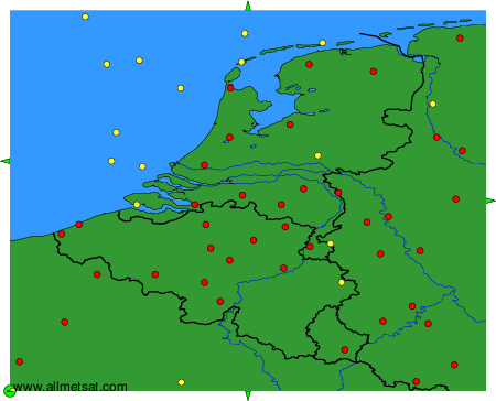
Weather observations and forecasts of more than 4000 airports (METAR and TAF reports).
The available stations are represented by yellow and red dots on the map.
Hover mouse over dot to see the name of the station.
Then click to see weather observations and forecasts.
To change the map : click on the green buttons with a black cross to zoom in, on the green button with a dash to zoom out, or on the green arrows for adjacent maps.
