METAR-TAF
Airports :
Kingston/Norman Rogers Airport
Kingston, Ontario, Canada
latitude: 44-13N, longitude: 076-36W, elevation: 305 ft
Current weather observation
METAR: CYGK 021510Z 05003KT 4SM -TSRA BR OVC021CB 22/21 A2983 RMK CB8 CVCTV CLD EMBD SLP102 DENSITY ALT 1300FT
Time: 11:37 (15:37 UTC)
Forecast
Broken clouds at a height of 12000 ft
from 02 at 14 UTC to 02 at 15 UTC
Broken clouds at a height of 12000 ft
from 02 at 14 UTC to 02 at 15 UTC
Overcast at a height of 4000 ft
from 02 at 15 UTC to 02 at 17 UTC
Overcast at a height of 4000 ft
from 02 at 15 UTC to 02 at 17 UTC
Overcast at a height of 1000 ft, Cumulonimbus.
Overcast at a height of 4000 ft
from 02 at 17 UTC to 02 at 18 UTC
Overcast at a height of 4000 ft
from 02 at 17 UTC to 02 at 18 UTC
Overcast at a height of 2000 ft, Cumulonimbus.
Overcast at a height of 2000 ft
from 02 at 18 UTC to 02 at 22 UTC
Overcast at a height of 2000 ft
from 02 at 18 UTC to 02 at 22 UTC
Overcast at a height of 1500 ft, Cumulonimbus.
Overcast at a height of 4000 ft
TAF: CYGK 021342Z 0214/0302 04007KT P6SM FEW040 BKN120 TEMPO 0214/0215 P6SM -SHRA BKN040 BKN120 BECMG 0214/0215 15010KT FM021500 15010KT 6SM -SHRA BR SCT008 OVC040 TEMPO 0215/0217 4SM SHRA BR BKN008 OVC040 PROB40 0215/0217 VRB20G35KT 1SM +TSRA BR BKN005 OVC010CB FM021700 15010KT 6SM BR SCT012 OVC040 TEMPO 0217/0218 4SM -SHRA BR BKN012 OVC040 PROB30 0217/0218 2SM TSRA BR BKN008 OVC020CB FM021800 15010KT 6SM -SHRA BR SCT005 OVC020 TEMPO 0218/0222 2 1/2SM SHRA BR BKN005 OVC020 PROB40 0218/0222 VRB20G35KT 1SM +TSRA BR BKN003 OVC015CB FM022200 15010KT 6SM -SHRA BR BKN020 OVC040 RMK NXT FCST BY 022000Z
Weather observations and forecasts of more than 4000 airports (METAR and TAF reports).
The available stations are represented by yellow and red dots on the map.
Hover mouse over dot to see the name of the station.
Then click to see weather observations and forecasts.
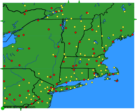
To change the map : click on the green buttons with a black cross to zoom in, on the green button with a dash to zoom out, or on the green arrows for adjacent maps.