METAR-TAF
Airports :
Springfield / Chicopee
Albany
Allentown
Andover
Auburn / Lewiston
Augusta
Barre / Montpelier
Bedford
Belmar / Farmingdale
Bennington
Berlin
Beverly
Binghamton
Block Island
Boston
Bridgeport
Burlington
Caldwell
Chatham
Chester
Coatesville
Concord
Danbury
Doylestown
East Hampton
Elmira / Corning
Falmouth
Farmingdale
Fitchburg
Fort Drum
Fort Indiantown Gap
Franklin County
Frelighsburg
Fryeburg
Fulton
Gatineau
Glens Falls
Greenville
Groton / New London
Harrisburg
Harrisburg / Middletown
Hartford
Hazleton
High Falls
Hyannis
Islip
Ithaca
Jaffrey
Keene
Kingston
L Acadie
Laconia
Lancaster
L'Assomption
Lawrence
Lebanon
Lennoxville
Linden
Lyndonville
Manchester
Marshfield
Massena
Meriden
Milton
Montauk
Montgomery
Monticello
Montreal
Montreal-Mirabel
Montreal Trudeau
Morristown
Morrisville
Mount Holly
Mount Pocono
Mount Washington
Nantucket
Nashua
Newark
New Bedford
Newburgh
New Haven
Newport
Newport
New York
New York City
New York / JFK
New York / LaGuardia
North Adams
North Kingstown
Norwood
Ocean County
Orange
Ottawa
Oxford
Pawtucket
Philadelphia
Philadelphia
Philadelphia / Blue Bell
Pittsfield
Plattsburgh
Plymouth
Plymouth
Portland
Portsmouth
Pottstown
Poughkeepsie
Providence
Provincetown
Quakertown
Reading
Rochester
Rockland
Rome
Rutland
Saint-Anicet
Sainte-Anne-de-Bellevue
Sainte-Clotilde-de-Châteauguay
Saint-Hubert
Sanford
Saranac Lake
Schenectady
Selinsgrove
Sherbrooke
Shirley
Somerville
Springfield
Springfield / Chicopee
St. Johnsbury
Sussex
Syracuse
Taunton
Teterboro
Trenton
Varennes
Vineyard Haven
Watertown
Waterville
Westerly
Westfield / Springfield
Westhampton Beach
Whitefield
White Plains
Wilkes-Barre / Scranton
Williamsport
Willimantic
Wilmington
Windsor Locks
Wiscasset
Worcester
Wrightstown
York
New England
Delaware
Maritimes
Maryland
New York
North America
Ontario, South
Pennsylvania
Quebec
Quebec, South
Virginia
Westover Metropolitan Airport Springfield / Chicopee, Massachusetts, United States
latitude: 42-12N, longitude: 072-32W, elevation: 246 ft
Current weather observation The report was made 29 minutes ago, at 07:55 UTC
Wind 5 mph from the South/Southeast
Temperature 72 °F
Humidity 88 %
Pressure 29.93 in. Hg
Visibility: 10 miles
Overcast at a height of 1700 ft
METAR: KCEF 020755Z AUTO 16004KT 10SM OVC017 22/20 A2993 RMK AO2 SLP137 T02220201
Time: 04:24 (08:24 UTC) Forecast The report was made 15 hours and 24 minutes ago, at 17:00 UTC
Forecast valid from 01 at 17 UTC to 02 at 23 UTC
Wind 7 mph from variable directions
Visibility: 659 ft
Few clouds at a height of 4000 ft Scattered clouds at a height of 15000 ft Broken clouds at a height of 25000 ft
Becoming
Wind 7 mph from variable directions
Visibility 6.2 miles or more
Scattered clouds at a height of 200 ft Broken clouds at a height of 2500 ft
Shallow fog
Temporary
Visibility: 13123 ft
Broken clouds at a height of 200 ft Broken clouds at a height of 2500 ft
mist
Becoming
Wind 10 mph from the South
Visibility 6.2 miles or more
Broken clouds at a height of 3500 ft
Temporary
Wind 12 mph from the South/Southwest with gusts up to 23 mph
Becoming
Wind 8 mph from the South
Visibility: 712 ft
Few clouds at a height of 6000 ft Broken clouds at a height of 25000 ft
TAF: KCEF 011700Z 0117/0223 19009KT 9999 FEW040 SCT150 BKN250 QNH2987INS WND VRB06KT AFT 0201 BECMG 0208/0209 VRB06KT 9999 MIFG SCT002 BKN025 QNH2991INS TEMPO 0209/0212 4000 BR BKN002 BKN025 BECMG 0213/0214 18009KT 9999 BKN035 QNH2990INS TEMPO 0215/0222 21010G20KT 510006 BECMG 0222/0223 18007KT 9999 FEW060 BKN250 QNH2989INS TX32/0119Z TN19/0210Z LAST NO AMDS AFT 0121 NEXT 0217
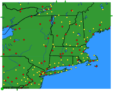
Weather observations and forecasts of more than 4000 airports (METAR and TAF reports).
The available stations are represented by yellow and red dots on the map.
Hover mouse over dot to see the name of the station.
Then click to see weather observations and forecasts.
To change the map : click on the green buttons with a black cross to zoom in, on the green button with a dash to zoom out, or on the green arrows for adjacent maps.