METAR-TAF
Airports :
Philadelphia
Albany
Allentown
Andover
Auburn / Lewiston
Augusta
Barre / Montpelier
Bedford
Belmar / Farmingdale
Bennington
Berlin
Beverly
Binghamton
Block Island
Boston
Bridgeport
Burlington
Caldwell
Chatham
Chester
Coatesville
Concord
Danbury
Doylestown
East Hampton
Elmira / Corning
Falmouth
Farmingdale
Fitchburg
Fort Drum
Fort Indiantown Gap
Franklin County
Frelighsburg
Fryeburg
Fulton
Gatineau
Glens Falls
Greenville
Groton / New London
Harrisburg
Harrisburg / Middletown
Hartford
Hazleton
High Falls
Hyannis
Islip
Ithaca
Jaffrey
Keene
Kingston
L Acadie
Laconia
Lancaster
L'Assomption
Lawrence
Lebanon
Lennoxville
Linden
Lyndonville
Manchester
Marshfield
Massena
Meriden
Milton
Montauk
Montgomery
Monticello
Montreal
Montreal-Mirabel
Montreal Trudeau
Morristown
Morrisville
Mount Holly
Mount Pocono
Mount Washington
Nantucket
Nashua
Newark
New Bedford
Newburgh
New Haven
Newport
Newport
New York
New York City
New York / JFK
New York / LaGuardia
North Adams
North Kingstown
Norwood
Ocean County
Orange
Ottawa
Oxford
Pawtucket
Philadelphia
Philadelphia
Philadelphia / Blue Bell
Pittsfield
Plattsburgh
Plymouth
Plymouth
Portland
Portsmouth
Pottstown
Poughkeepsie
Providence
Provincetown
Quakertown
Reading
Rochester
Rockland
Rome
Rutland
Saint-Anicet
Sainte-Anne-de-Bellevue
Sainte-Clotilde-de-Châteauguay
Saint-Hubert
Sanford
Saranac Lake
Schenectady
Selinsgrove
Sherbrooke
Shirley
Somerville
Springfield
Springfield / Chicopee
St. Johnsbury
Sussex
Syracuse
Taunton
Teterboro
Trenton
Varennes
Vineyard Haven
Watertown
Waterville
Westerly
Westfield / Springfield
Westhampton Beach
Whitefield
White Plains
Wilkes-Barre / Scranton
Williamsport
Willimantic
Wilmington
Windsor Locks
Wiscasset
Worcester
Wrightstown
York
New England
Delaware
Maritimes
Maryland
New York
North America
Ontario, South
Pennsylvania
Quebec
Quebec, South
Virginia
Philadelphia International Airport Philadelphia, Pennsylvania, United States
latitude: 39-52-06N, longitude: 075-13-52W, elevation: 20 ft
Current weather observation The report was made 40 minutes ago, at 06:54 UTC
Wind 13 mph from the South with gusts up to 22 mph
Temperature 79 °F
Humidity 89 %
Pressure 29.73 in. Hg
Visibility: 5 miles
Broken clouds at a height of 2000 ft Broken clouds at a height of 4500 ft Overcast at a height of 5500 ft
mist
METAR: KPHL 030654Z 19011G19KT 5SM BR BKN020 BKN045 OVC055 26/24 A2973 RMK AO2 RAE09 SLP066 P0002 T02610244 $
Time: 03:34 (07:34 UTC) Forecast The report was made 2 hours and 11 minutes ago, at 05:23 UTC
Forecast valid from 03 at 06 UTC to 04 at 12 UTC
Wind 7 mph from the South
Visibility: 6 miles
Broken clouds at a height of 1200 ft Overcast at a height of 3500 ft
light rain showers, mist
Temporary
Broken clouds at a height of 800 ft Overcast at a height of 2000 ft
From 03 at 1000 UTC
Wind 12 mph from the South/Southwest
Visibility: 4 miles
Broken clouds at a height of 800 ft, Cumulonimbus. Overcast at a height of 2000 ft
light rain showers, mist, thunderstorm in vicinity
From 03 at 1400 UTC
Wind 14 mph from the Southwest
Visibility: 3 miles
Overcast at a height of 2000 ft
light rain showers, mist
Probability 30%
Visibility: 3 miles
Overcast at a height of 2500 ft, Cumulonimbus.
thunderstorm, rain
From 03 at 2300 UTC
Wind 9 mph from the Northwest
Visibility: 6 miles
Broken clouds at a height of 12000 ft
TAF: KPHL 030523Z 0306/0412 19006KT 6SM -SHRA BR BKN012 OVC035 TEMPO 0306/0310 BKN008 OVC020 FM031000 20010KT 4SM -SHRA BR VCTS BKN008CB OVC020 FM031400 23012KT 3SM -SHRA BR OVC020 PROB30 0317/0320 3SM TSRA OVC025CB FM032300 31008KT P6SM BKN120
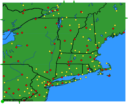
Weather observations and forecasts of more than 4000 airports (METAR and TAF reports).
The available stations are represented by yellow and red dots on the map.
Hover mouse over dot to see the name of the station.
Then click to see weather observations and forecasts.
To change the map : click on the green buttons with a black cross to zoom in, on the green button with a dash to zoom out, or on the green arrows for adjacent maps.